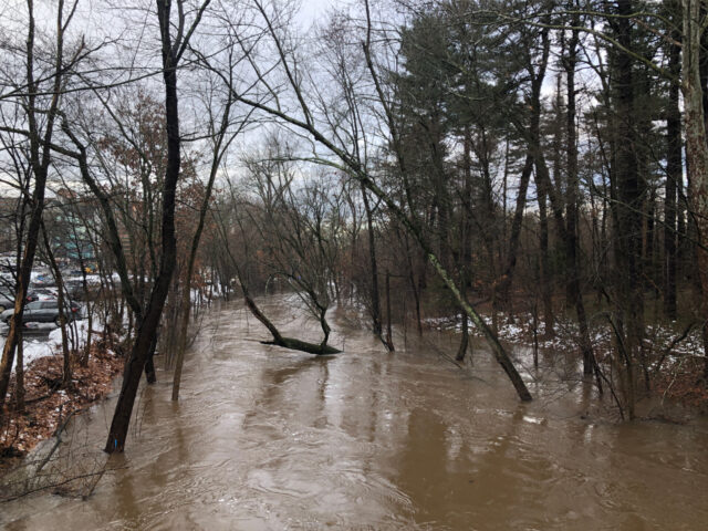
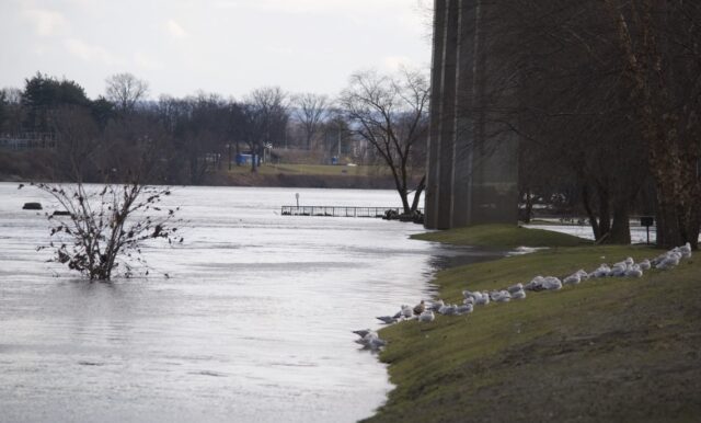
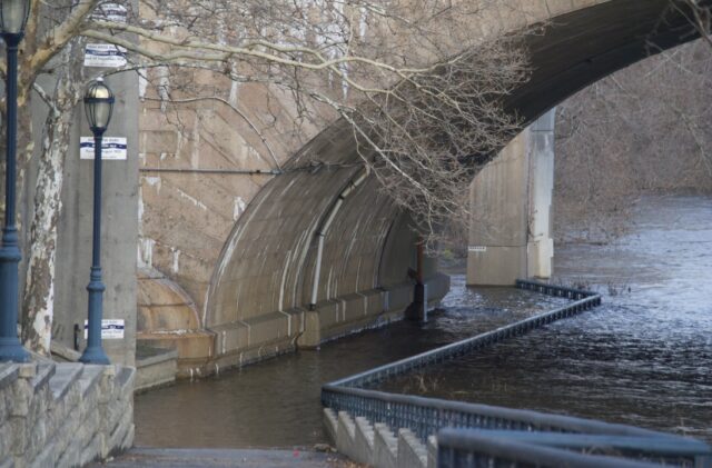
The photo above is of the channelized section of the Park River, view from the Hamilton Street bridge. I don’t recall water levels reaching this height before. This was taken on Saturday, January 13, 2024. Below, the Park River as viewed from the Asylum Avenue bridge on Wednesday, January 10, 2024.
It’s what I would have expected during the spring flood or following a hurricane. This season, we’ve had exactly one snow event resulting in any accumulation. What we’re seeing now absolutely fits the definition of what to expect when you’re expecting climate change.
Imagine if we had let nature be, not shunting rivers into concrete basins, not burying them underground.
If you’re about to comment on how we should daylight the Park River in downtown Hartford, stop yourself right now and take a deep breath. Keep reading with an open mind and curiosity.
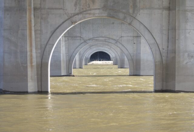
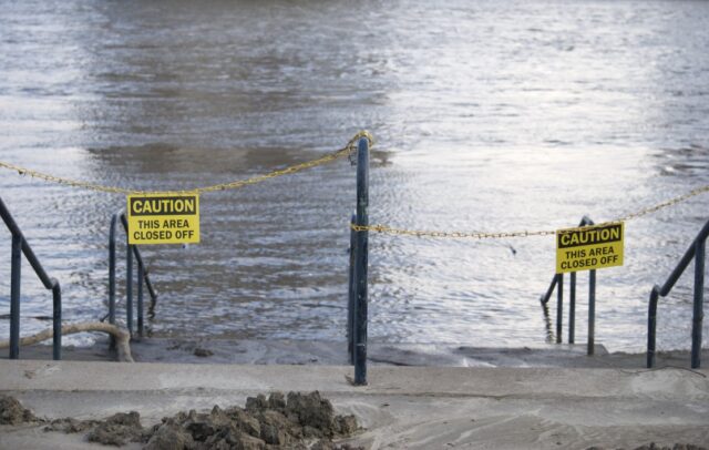
The photo above is the Connecticut River, as viewed from the Riverfront walkway on Sunday, January 14, 2024. Some of the path was open, but some was impassable still. The waters appear to be receding, with deposits showing how high the water was recently. Picnic tables at Charter Oak Landing have traces of silt on their tops. Usually if portions of the park are closed at this time of year it’s because of snow or ice on the stairs and trails.
The burial of the Park River from Pope Park to the confluence with the Connecticut River captures the attention of urbanists whose possible interaction with the river would most likely be in downtown. The calls to unbury it came as soon as the project was done, so there’s nothing new happening here.
Daylighting the river would not be as simple as prying off a giant lid.
There are two ways to know this without copious research about hydromorphology.
One way: listen to the chatter about the careless attachment to the idea of “placing” I-84 underground. Tunnel projects are extensive and expensive. There’s the obvious joke about the vanity of tunneling hobbyists, yet it’s not a joke when we know it as disruption. Instead of asking if we can afford this or not, we should be asking what the hell gives us the right to mar the Earth. Back to freeing the Park River from the conduit: this is a reverse tunnel project.
Another way: go looking for historic photographs of the Park River construction projects. For me, this was what brought clarity about the scale of what was done to desecrate this and many other streams and rivers around the globe.
A question we should be asking before proposing an undoing of the Park River burial mistake: why?
I ask you to ask this question because there are so few local voices who show a consistency in asking for rewilding of the entire Park River. The trend has been to focus on Park River from Bushnell Park to Connecticut River exclusively, trying to put all our smashed eggs in one basket, instead of viewing this as a portion of a larger project.
Are you asking for the daylighting because you would like a little river for aesthetic purposes?
Have you considered the rest of the Park River well beyond the section from Bushnell Park to the Connecticut River? Beyond downtown? Have you spent time walking along the South Branch? Have you walked the North Branch? Have you spent time thinking about a river’s essence and how it is meant to function naturally?
Is our desire to open up the river one that is people-centered, or are we considering this in a larger ecological context?
I ask because instead of single-mindedly pursuing a return of the Park River to downtown Hartford, we should be voicing desire for an improvement of the rest of it.
Something was very wrong in the last century for society to agree to move river beds, fill them with concrete, and send them into pipes. Don’t be fooled by the oft-repeated and rarely fact-checked claim that this was a measure needed for flood prevention. It was motivated by the greed of real estate and highway building.
We need to think about what provoked the errors of the past to ensure we do not make the same ones.
Are we motivated purely by human desire, or are we taking into consideration the health of the environment?
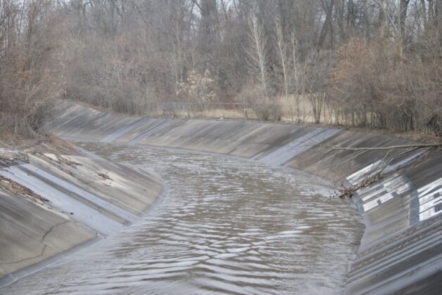
The one mile section from Pope Park to across from Pulaski Drive is channelized. It has a concrete bed and walls. You can see the water, but there’s not much to see. To view it up close you have to go around fences, down steep inclines, and basically walk in places without permission. Otherwise, you need to look from bridges, of which we recently lost one now that the Olive Street footbridge is blocked off.
Normally, water levels are so low that the bicycles, tires, and shopping carts lazily dumped into the river can be viewed clearly from bridges. It’s not entirely devoid of life, but it’s extremely challenged.
If you manage to walk from the channelized section to the part that I’ll call natural (even though that’s also been tinkered with) the difference is immediate. You might notice that it feels like a place you want to be before you realize that the concrete is gone. It begins to sound like a river.
Doesn’t it seem like the logical path would be to first restore the riverbanks and riverbeds that are adjacent to the more wild section from Trout Brook and Piper Brook as it becomes the Park River, that area across from Pulaski Drive to Pope Park? It matters that we address what is upstream.
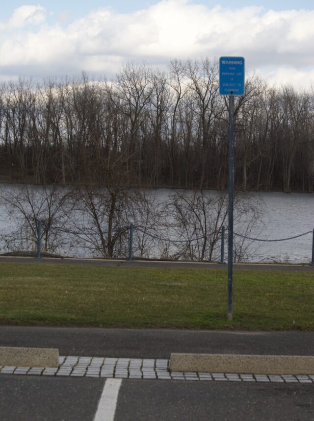
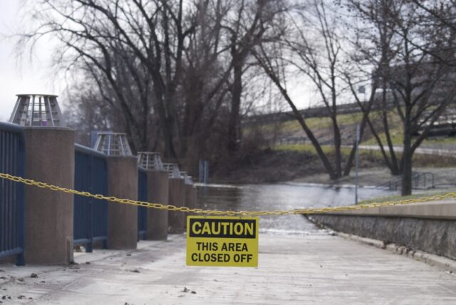
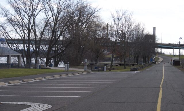
Simultaneously, we should be dealing with what has been allowed to exist too close to the Park River, and from what you can see in the photo above and below, to the Connecticut River: paved parking lots. Go to Google Maps and use the satellite view to follow along the Park River, both branches, and observe how many parking lots are very close to it.
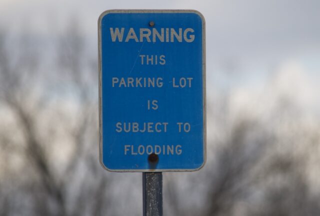
The North Branch Park River Watershed Management Plan made this recommendation over a decade ago, pointing out the problems caused when large surface parking lots abut this or any river. Unfortunately, very few property owners made any improvements in the time since. If you look at the second photo toward the beginning of this post, you can see the State of Connecticut parking lot to the left, too near the Park River.
Although the plan focused on the North Branch, its wisdom applies to the South Branch and to the Connecticut River. Is there any reason to have so much pavement in areas that flood? This isn’t my concern because of the damage water might do to the lots and vehicles left in lots, or because the paths become inaccessible when the river is high, but because impermeable pavement contributes to the problem of flooding.
At the same time, we could be doing major clean up projects in and along the Park River.
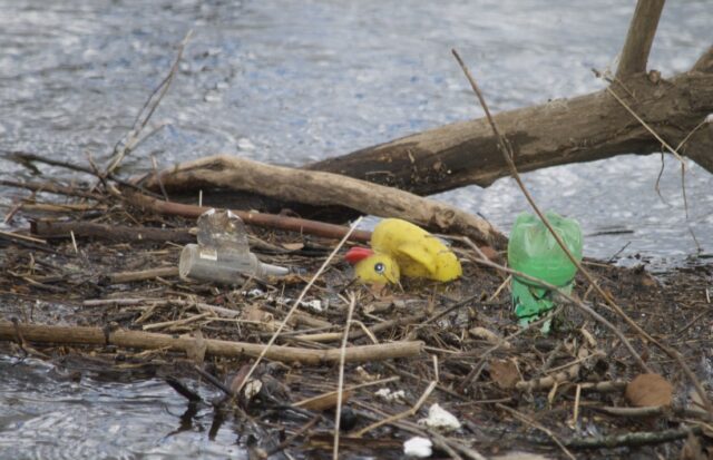
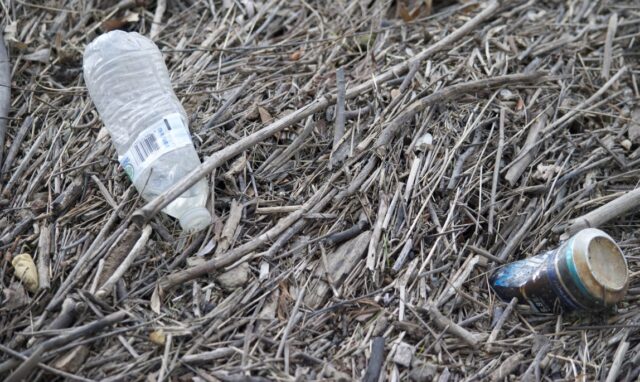
Part of what made the downtown portion of the Park River unappealing when it was exposed was that it was polluted. Besides residents tossing whatever they felt like into it, factories upriver were dumping into it because at the time there was not a whole lot in the way of environmental regulations.
We’ve gotten better — not perfect — at restricting how businesses treat the river, yet do a lousy job collectively when it comes to keeping litter out. The Connecticut River Conservancy holds clean ups every September; that’s not nearly enough to deal with the problem which has more to do with overconsumption of non-biodegradable single-use products than it does with people individually being careless with trash. We have to reckon with our recklessness, and in the short-term have focused trash removal from watersheds, perhaps involving a wider range of the population than who usually participates because it is educational to wade through this amount of refuse.
Can we get a handle on this?
Then, after addressing the re-naturalization of exposed-but-degraded sections, mass depaving combined with transition to permeable pavement where a harder surface is needed, and major clean up actions, then it seems appropriate to move on to larger projects: daylighting all parts of the covered Park River.
All. Not just what might be pleasing to those in downtown.
This would include the segment from Pope Park to Bushnell Park, the segment near Hartford Public High School and the Twain House that was explicitly buried to allow for I-84, and the section that people refer to when they talk about daylighting the river: that which ran from Bushnell Park, below what is now the needless Whitehead Highway, and then exiting into the Connecticut River.
What about 84?
What about it?!
Kondo that shit.
Climate Possibilities is a series about climate mitigation, along with resilience, resistance, and restoration. It’s about human habitat preservation. It’s about loving nature and planet Earth, and demanding the kind of change that gives future generations the opportunity for vibrant lives. Doomers will be eaten alive, figuratively. All photographs are taken in Hartford, Connecticut unless stated otherwise.
Casey Moran
Agreed that the section from bushnell to the river is the least “important” here, my thoughts are:
1) Unchannelize and build a Greenway along the banks of the park river N-S Farmington ave to Elmwood to allow people to reconnect to the river and develop an appreciation for it while providing a safe way to move around outside the automobile
2) Develop a sunken “river” park in the white head highway cut – not via a full daylighting of the river but rather using pumps to divert a measured amount of the river to the surface before it dives back down to rejoin the river (~at Columbus). This would prevent flooding issues, allow the park to be accessible all year-round, and allow the flow to work with the current levee system
Agreed that a full daylight would be not only challenging and expensive but come with many unintended consequences many have not thought through
Donna Fleischer
I rely on your Real Hartford reports from Hartford, CT. Have for years. I’m a Hartford native and love this city to its marrow.
How to thank you?
Sincerely,
Donna Fleischer