
Instead of screaming into the void of Twitter, I bring you a weekly highlight reel of what it’s like going places in Greater Hartford when one is gloriously car-free. These posts are on a slight time delay because nobody needs to know exactly where I am when I am there.
Heat waves get called “oppressive” and they are, but they are also soul-sucking, energy-draining, ambition-destroying, and misery-making. That’s all to say, I enjoy when it’s cool enough to want to walk anywhere. This last week, I made up for some of what was lost in the previous week, two weeks, walking for enjoyment and not just to employment.
While out, I saw two sections of Hartford street that were recently modified.
Come process this with me.
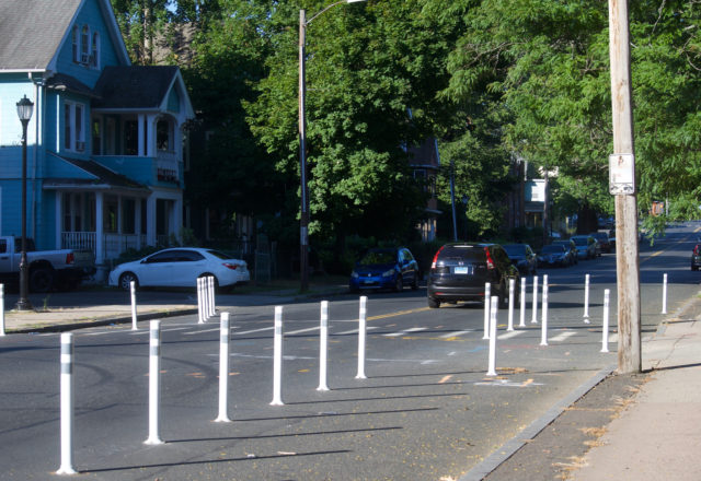
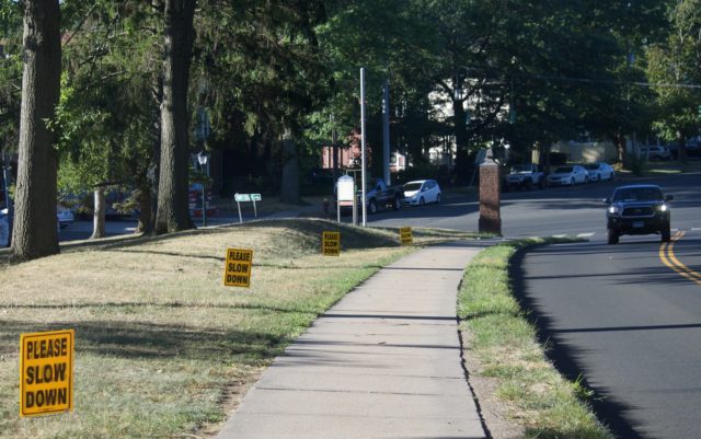
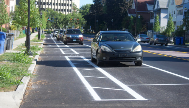
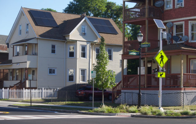
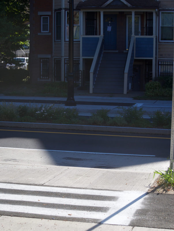
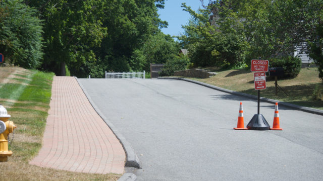
This is New Britain Avenue at Henry Street, where a driver killed Jillian Hegarty and injured two others on March 31, 2022.
For those just tuning in: when I asked the elected officials immediately after what they were going to do to ensure this did not happen again, the Council President told me in an email that it was not her job. After explaining to her how the City Council approves budgets and passes laws (what did she think she was there to do?!) I wrote her off as a lost cause, but did hear back from the Bike/Ped Junior Planner, who gave me a list of all the changes in this area that would be happening in the next year. While I think she could go a lot harder, she’s reasonably responsible with the public’s trust.
So, the flex posts have been added, and as I walked through the area, I realized that my brain struggles with flex posts when they are arranged in any way except to delineate a bike lane. It’s hard to instantly know what I’m looking at or how to navigate it, and I suppose that’s part of the point.
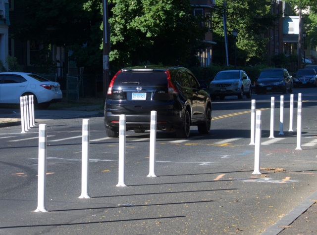
The response from drivers around them — here and elsewhere — is. . . interesting.
I watched as car-after-car was driven over the double yellow line. Speeds did not seem substantially reduced in this spot, and that has been part of my critique about how Hartford and elsewhere manage road design. It’s so fragmented. People were still flying down the road, then slowing a touch if they could not move to the center, and then speeding right back up.
I watched as the driver of the red pickup had ample time to stop, but rolled right through the red light.
Other treatments are on the way, hopefully soon, before drivers realize that these flex posts are not filled with concrete. (If I were retired and bored, I would spend my time filling them with concrete)
What happens is that those who only do business in the area during business hours don’t realize what these roads look like during the times that the deadly crashes happen. Congestion is not leading to crashes. It’s the wide open opportunity to speed.
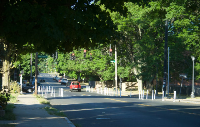
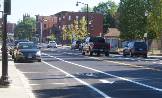
Here’s Summit Street, early on a Sunday morning.
Nobody was driving the speed limit.
And those signs on campus imploring people to drive slowly? Adorbs.
And the mega-sign asking the same? Super cute.
Right in that area is where I watched someone pull a not-at-all-careful u-turn in the New Britain Avenue/Summit/Fairfield intersection before screeching east down New Britain Avenue.
I’m not sure they were moved by the pleas.
I won’t understand how putting signs everywhere that ask drivers to look somewhere besides the roadway makes sense, but whatever. It’s an effort, and that’s more than we typically get in a culture that’s largely accepted car crash fatalities as collateral damage.
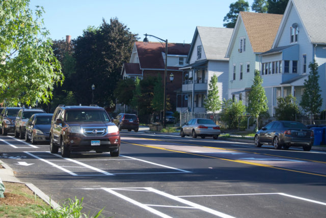
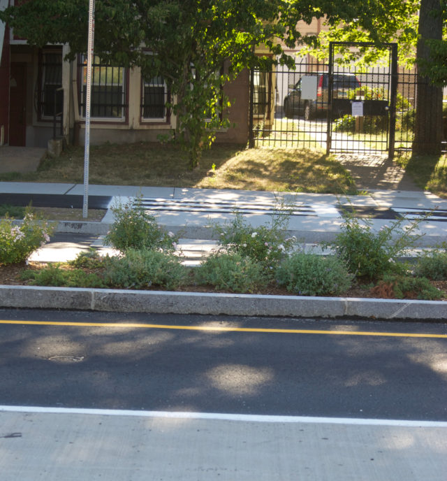
About a mile away in the South Green neighborhood, there are changes on Franklin Avenue between Annawan Street and the intersection with Maple Avenue, and then on Maple Avenue until Retreat Avenue. This is the area where Josue Colon was hit and killed by a driver while he rode a scooter on September 5, 2021.
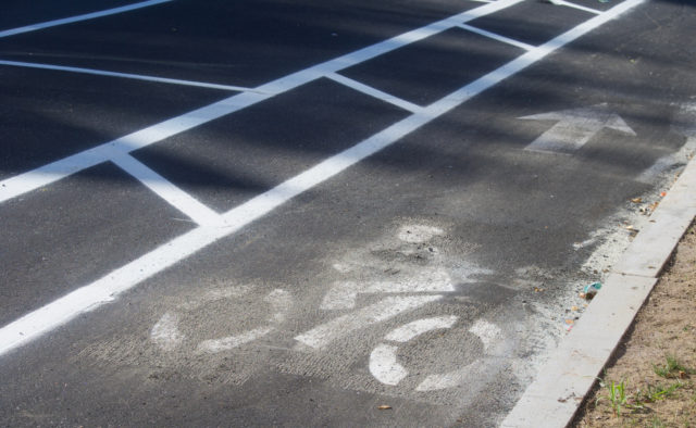
There are variations of a bike lane happening here now. I feel the pressure to be a cheerleader about this, but first of all, why does this look like someone licked their finger to get rid of a little schmutz? And also, how do we have this many varieties of bike lane on two blocks?
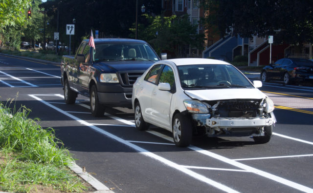
While we’re asking questions, how is nobody flagging every single car that’s out like this? It’s clear some shit went down. How you driving around like this? Obviously, can’t be bothered to park inside the lines.
But! Because the bike lane was not striped terribly in this section, the drivers managed to park somewhere that was not obstructing cyclists.
Here’s another shot of a rare, unobstructed bike lane.
I’d prefer some flex posts or a guardrail running in between, but this is still a huge improvement over…
GD.
WHY?!
But…why?
No, really. Why.
I don’t understand switching the positioning of the lane, the loss of the painted buffer.
Do not get in the comments and talk down to me about lane widths. There are other solutions.
But, whatever. I’m happy to see Hartford doing something and having it crystal clear where on-street parking is allowed should minimize driver stupidity.
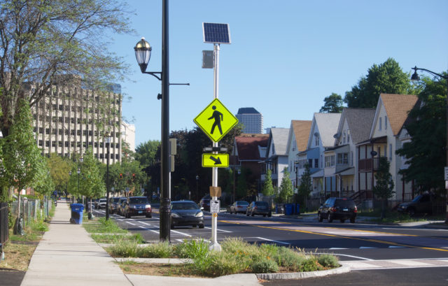
There’s more than bike lanes here. The City made it possible to actually cross Franklin Avenue by narrowing the road width, adding a noticeable crosswalk, and installing those hi-vis signs with flashy lights.
Now, this is a dramatic change, and a smart one. Wethersfield Avenue, running parallel, had been modified last year. You don’t want to make one street slower and do nothing to the next closest one that would serve as an alternative racetrack.
It’s not crash proof.
Nothing is.
But it is better.
Except for this thing that I cannot figure out.
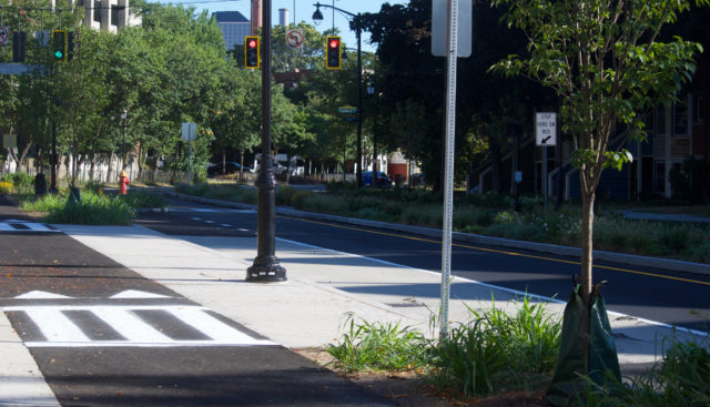
It looks like shark teeth before a crosswalk — telling cyclists to stop for pedestrians.
Cool, cool.
But. . .
What is happening? The crosswalk just. . . ends?
There’s a median with plants that I could trample through. Can’t get a stroller or wheelchair through, probably.
Communication fail about what would be going where?
Or is this not a crosswalk? Is it some sort of road treatment that nobody knows intuitively what it means?
Is it a crosswalk to help people get to the plants only?
Do I have any conclusion? I don’t know.
Could we be moving along faster with these changes?
Yes.
Have we seen more substantial changes in the last two years in Hartford than in the last two decades?
Also, yes.
The proof will be if we see cyclists using the lanes instead of the sidewalk.
QUESTION
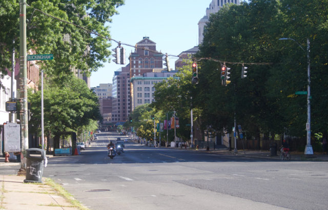
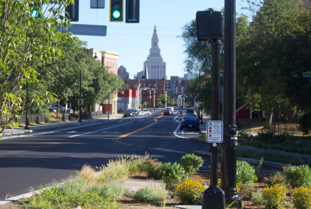
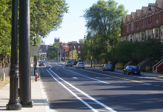
This is Main Street.
When’s that road diet and barrier-protected bike lanes going to show up?
TRANSPO FAILS
Amtrak arrives late to Hartford by about half an hour. This does not even make it to the Hartford Line Alert feed. Arriving in New Haven, the Shore Line East replacement bus that I would’ve been about 20 minutes early for is long gone. I’m assuming it arrived on time. I wait around for about ten minutes, then leave. The next SLE train is not for about 3.5 hours after the first scheduled one. This throws my plans off. I have to decide, now that I’m in New Haven, what my next move is. The eastbound SLE train arrives exactly on time. I go. Do my thing. The return SLE train arrives about five minutes early. But then we wait on the tracks for about 15 minutes in all, waiting for another train to pass as they’re down to single-track because of a construction project. This delay does not screw me over, but it’s knowing that nothing is predictable which makes planning anything hard. I will keep asking again and again: why is the last train out of New Haven on Saturdays at 7:30 PM?
Just to be clear, unlike a whole lotta other people, I am not horny for high-speed rail.
All I want are simple things: show up when you say you will, communicate better, don’t make me wait around on your ass.
AS SEEN ON THE SHORE
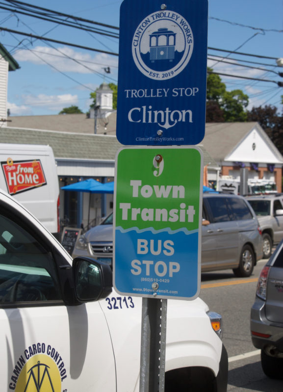
I still can’t wrap my head around how some other transportation management companies do things, but I like their signs.
Oh look, Clinton has a road that is not for cars.
JK, this is a “community” with million dollar homes, and when you’re one of those, you can decide to ban cars.
WHAT NEXT
Critical Mass! Meet at the Bushnell Park carousel on August 26th.
Gina
Have you seen any of the videos on Not Just Bike’s YouTube page? It’s all about designing infrastructure at human-scale, and deprioritizing cars.
Kerri Provost
I haven’t watched them, but I’m familiar with the human-scale design concept.