Cooling off doesn’t have to mean joining half of Connecticut on the beach; it can be going into the woods to escape the urban heat island effect. Within a 10-minute walk of the last stop on the 913 Manchester-Tolland-Storrs express there are multiple hiking trails, and many more if you extend the walk or bring your bike along.
When I think about Mansfield, it’s two thoughts: this is where the hiking trails are, and that very specific part of town that everyone knows might have more amenities now, but it’s a loss not having Cafe Earth, The Sugar Shack, the music shop. . . and so I have nothing to say about that very specific part of town.
But, growing up in a neighboring town and having no affiliation with that specific famous thing in that very specific part of Mansfield, I’ve always known this as a place of outdoors, old houses, artists. It’s where we had a field day in middle school, and where later in school, we were taken to hike seemingly unnamed trails with paper maps in the time before cellphones. Without having any paths memorized, this all feels like home in a way that other parts of the state do not.
In the time since I left, it seems more hiking trails have opened, or perhaps it’s just that there are signs and names now for where we had been walking all those years. I’m grateful for the preserves and land trusts that seem to be the only force reining in that Specific Famous Thing that grew so big, so fast that it decided it was entitled to the water from another town.
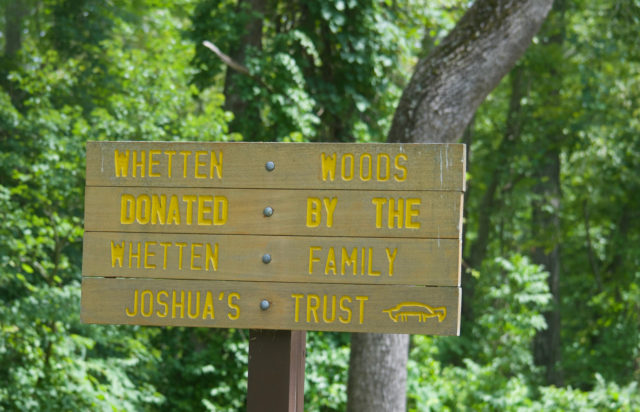
Joshua’s Land Trust, which protects upwards of 4500 acres in 14 eastern Connecticut towns, has its headquarters in Mansfield. In Mansfield alone, there are currently around two dozen properties — 850 acres — preserved by this land trust; three of these are within a 15-minute walk of a 913 bus stop.
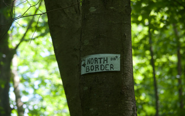
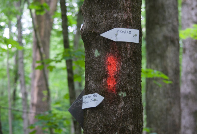
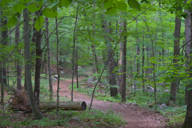
One of the Joshua Trust properties is Whetten Woods, nearly 36 acres. Whetten Woods has a few entry points, but the one I was interested in was less than half a mile from the Mansfield Transportation Center, accessible from the Hope Lutheran Church property.
The sign is readable from the sidewalk, and you can quickly scan the area behind the church and immediately figure out where to go. If you go out walking enough, you know how a trailhead without a sign suddenly makes you feel like you’re about to commit ten crimes, skulking around.
Do you want massive cliffs? Rapids? Stunning vistas?
Calm yourself down.
Enjoy a relatively short, peaceful walk through woods with chattering birds.
Are the trails well-marked?
Confession: I tend to not pay attention to trail markings. I’m not saying that’s advised behavior. It just is what it is.
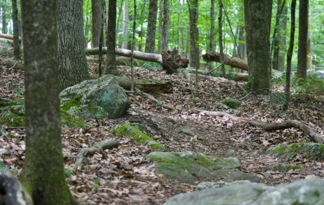
There are a lot of trail markings here that often don’t seem consistent, and when I know an area is not all that large, I don’t worry myself over knowing which trail I’m on. It’s ten minutes, max, from any nearby road.
This is allegedly a looping trail, but there are also spurs that go to haunted exercise equipment and possibly elsewhere.
This is a first stop, not a last one. Think of it as whetting your appetite for more prolonged hiking.
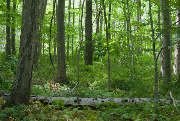
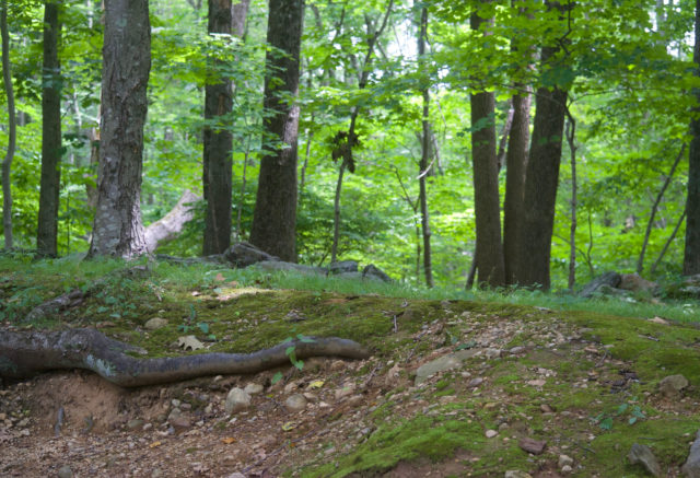
Whetten Woods has narrow, but cleared, trails with some of the features I most enjoy about walking in the woods in this part of Connecticut: rocks and roots in the path.
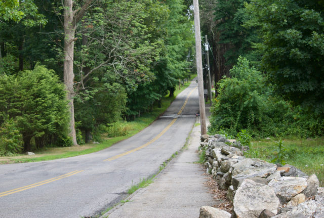
After getting your fill of that, make your way back up Dog Lane. It’s easy to remember the way because right now, sidewalk only goes as far as the church with the trailhead out back.
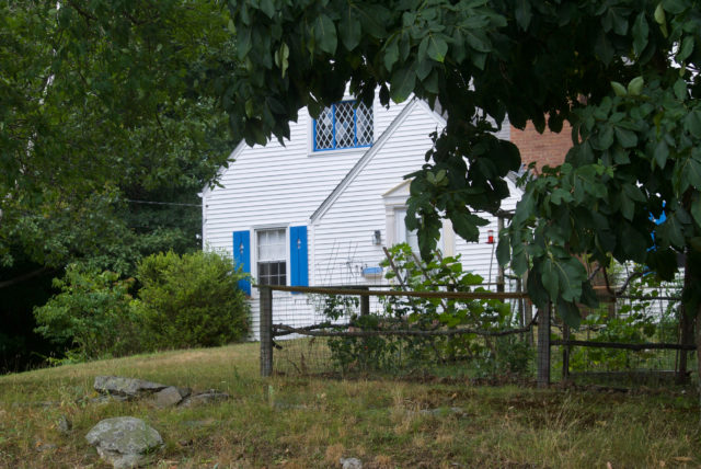
This is the hiking experience in Mansfield: finding a trail without having to dodge parking lot traffic jams, wandering for a bit, and then coming out near cute homes.

In one of those aforementioned gym classes, we were dropped off when there were thunderstorms looming. The teacher said he’d meet us at the end of the trail with the van. One person had a map. Nobody had a compass; this was before smartphones. After about 45 minutes, the thunder began. Dogs howled from what everyone hoped was an unseen kennel. Another time, the Fenton River flooded a trail; we were guided through waist-deep water, anyway.
When I think of Mansfield, it’s that: thwarted misadventure.

As much as I might have wanted to pretend that the behemoth did not exist, it was unavoidable, seeping deeper into the side streets.
There are other nearby hiking/walking places that are not Joshua Trust properties.
Hiking can mean walking in nature, but I think it implies lots of effort, so these are more like walking in nature with slight effort, mostly to swat away mosquitoes.
The Town of Mansfield, as in, the municipality, maintains about a dozen parks and preserves. Among them is Moss Sanctuary located off of South Eagleville Road. Look for the bus shelter across from Mansfield Town Hall and Community Center, and take the sidewalk between the Mansfield Apartments. This is another haunted experience, perhaps because it’s summer. A functional bicycle was the only sign of recent human life in the barracks-style apartments.
Take the steep wooden stairs down, and continue straight. When you cross the (at least during summer) empty lot/driveway/road there is an unmissable sign.
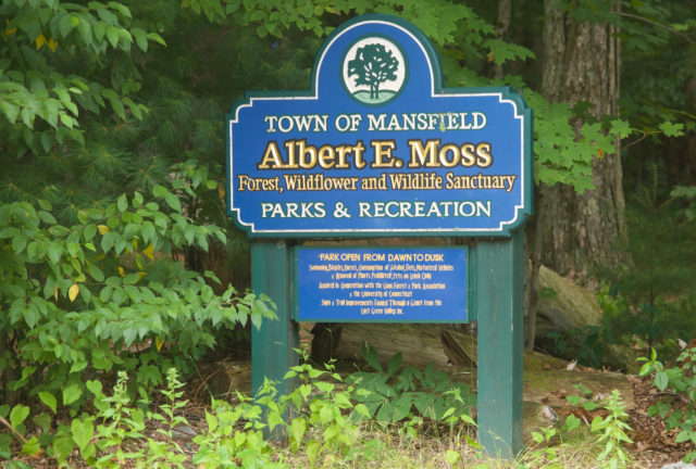
Moss Sanctuary — or Albert E. Moss Forest, Wildflower and Wildlife Sanctuary, if you’re nasty — has two looping trails within 135 acres, where you can always hear Route 195 in the distance, but not louder than the birds and cicadas.
On Google Maps there is something in this area labeled “Cicada Research,” and while failing to figure out what this is, I distracted myself by UConn’s NatureRx page which is the kind of resource I would’ve killed for (okay, not killed. Paid for.) when I lived out that way, or really, anywhere. This is handy for those who want to know if an outdoors place is open to their use; not everyone is comfortable finding green space on the map and deciding to go regardless of who owns the property. It shows which properties have benches and where, and points out the bikeways and suggested bicycle routes.
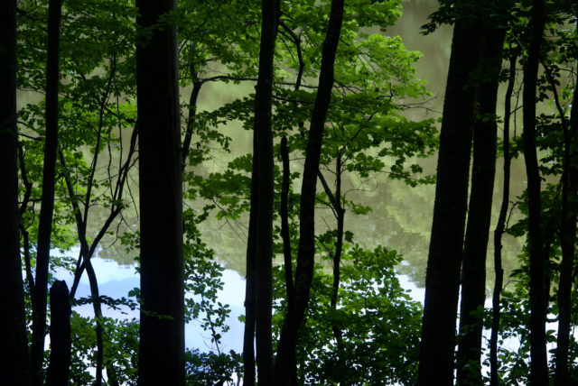
What I can tell you about Moss Sanctuary is that there’s a pond, wildflowers, and indeed, moss. (For those fascinated with moss, I recommend reading Gathering Moss.)
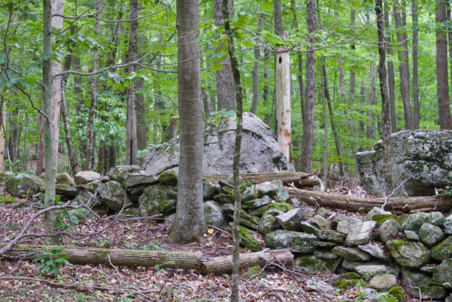
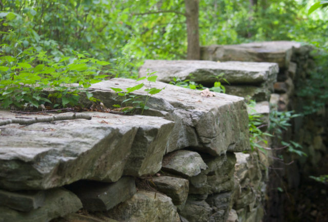
There are stonewalls because this had been farmland and is in New England. Stonewalls are a requirement.
And there are the cicadas, who might be more impressive in 2024. Maybe a cicada-ologist will leave a comment about where their hidey-holes are.
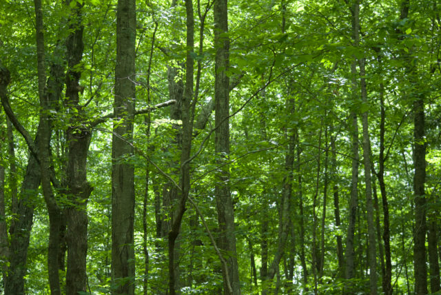
There are roots on the trail, another personal preference.
Trails that are not super wide and smooth require more attention. The temptation to walk while doomscrolling is gone if I have to watch for tripping hazards. This is the closest to meditative activity as I can get. It was one more thing I learned to appreciate in that gym class that could not possibly exist today (too many waivers) — walking up hills on root-covered trails is a fast way to discover how to pay attention to what you are doing and stop obsessing over how you compare with anyone else in the group.
So many trails.
So many options.

If you’ve got a bicycle and/or feel up to navigating Windham Region Transit District, a few other options for hiking around in Mansfield include:
Dunhamtown Forest and Dunham Woods: These two adjacent tracts total 243 acres and are a 1.3 mile (25 minute) walk from the Mansfield Transportation Center and about 20 minutes from the Moss Sanctuary. These two tracts have 3.9 miles of hiking trails.
Shelter Falls Park: 1.7 miles of hiking trails, with a waterfall. This is accessible from the bike path on Hunting Lodge Road and from adjacent North Eagleville Tract (139 acres)
Fenton Tract: Numerous trails and trail heads in this 580-acre part of the UConn Forest. One entrance is on Gurleyville Road, 1.1 miles from the Mansfield Transportation Center.
Torrey Preserve: 1.6 miles from the Mansfield Transportation Center, with a trailhead on Gurleyville Road. The Nipmuck Trail runs along a part of this 30-acre parcel.
Fifty-Foot Cliff Preserve: It’s more like 100 feet, this cliff. There are 102 acres here behind the Mansfield Historical Society. There’s a giant anthill. This is 1.5 miles from the Mansfield Transportation Center.
Commonfields: In Mansfield Center, 18 acres, but a very short hiking trail across a field. It’s next to the Old Mansfield Center Cemetery, the oldest graveyard in Tolland County.
Mansfield Hollow State Park: This is 4.5 miles from the Mansfield Transportation Center and across the street from UConn’s Spring Hill Tract. You could put bike on a WRTD bus, get off at the Mansfield Center stop, and then ride less than a mile to a path from Southeast Park. This is a place to go if you like rocks.
Sawmill Brook Preserve and Wolf Rock Preserve: This is 5.8 miles from the Mansfield Transportation Center; suggest putting bike on the WRTD bus to shorten trip. The two properties combined total 188 acres with three miles of hiking trails. This is another place to go if you like rocks.
For more Mansfield hiking and outdoor options see:
Getting to Mansfield:
Take the 913 Manchester-Tolland-Storrs Express bus from Hartford. It begins at the Sigourney Street CTfastrak station (platform D, even though there’s no sign for it) but there is also a stop on Sigourney Street in front of the insurance building, along with several in downtown. Do not chug coffee before getting on this bus; it takes awhile to get to Storrs as there are stops in Manchester that require winding around. Related: within just a couple minutes of the final stop at Storrs (Mansfield Transportation Center AKA Nash-Zimmer Transportation Center), there are unlocked public restrooms at the Barnes & Noble and Starbucks; as of publication.
Now, this one seat ride should have been a simple trip for me — but, no.
Watch this video first to get in the spirit: “the quest to understand it could be its own academic discipline.”
Open up your calendar.
Do some deep breathing exercises.
The people at CTtransit who planned this either assumed only students would use this route or grossly overestimated how much joy the average person derives from reading schedules.
Do not try to shortcut this by opening up the Transit or Google apps, because if it’s a day with a delay — explained in a minute — you’ll still know when the bus is coming, but the app will not give you an alert that then the driver will sit there for 30 minutes. Nobody has time for that!
If you’re aiming for a weekend trip, the ride is fairly straightforward. A few days are marked “Saturday only” but that’s clear in the schedule.
A weekday trip is where things get freaky. At a glance, it looks like there’s loads of service on this route, and there is, when the planets are aligned. You want to make it to Mansfield to walk around and pet moss? Prepare to sacrifice something first for the privilege.
Trips marked with an L mean that if UConn is not in session, the actual time is roughly 30 minutes later than what’s on the schedule. An X means that trip does not happen at all if UConn isn’t holding classes. An F means the trip happens on Fridays only when UConn is open.
If you’re unaffiliated with UConn, how do you know what they’re doing? I’d say to “scroll down on the schedule”, but the calendar is, as of publication, one year out of date.
A P in the schedule means Peter Pan is operating instead of CTtransit. Normally, that means the ride is more expensive.
I will give them this: the last bus out of UConn on weekdays and Saturdays is 10:45 PM.
Public transportation should not be this complicated.
At least through December 1, 2022, the bus is free.

Mary noonan
Nice article. Funny and makes me want to take a hike