“WTF is in Wallingford?”
I know, right?
I’d wondered about that every time riding the train between Hartford and New Haven.
The train stops in Wallingford. There must be a reason.
I had been to Wallingford a few times before. Once was to do a home visit for work and I spent quite awhile hopelessly lost because GPS went wild in one area. Another time was to visit a friend. The most memorable was getting into a fight with skinheads at a show and needing to leave ASAP. It was a long time ago, couldn’t tell you which bands we were there to see, and all I know is that I didn’t get my ass beat and I ate Taco Bell after. Notable, since I’ve had Taco Bell fewer times than I’ve been to Wallingford.
It felt time to see what else Wallingford had to offer besides white supremacists at metal shows.
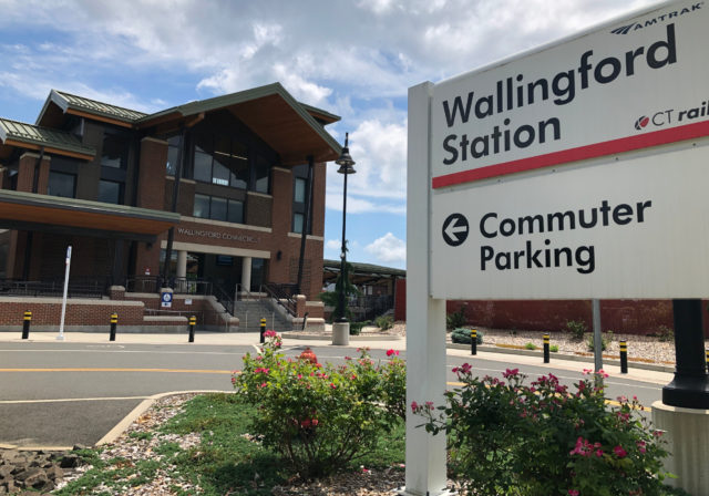
Entering town through the train station, I set out on foot to see whatever there was to see in a few hours.
Immediately, I started off in the wrong direction. There was a half block of beautiful houses, with a noticeable quiet aside from birds singing. It was pleasant.
Then, after five minutes, when I realized I was going in the exact opposite direction from where I intended, the traffic noise began. That is what was most memorable about an afternoon in Wallingford: so much car noise pollution. This was perhaps not helped by what appeared to be a higher than average ratio of oversized pickup trucks. Looks like a village, sounds like a highway.
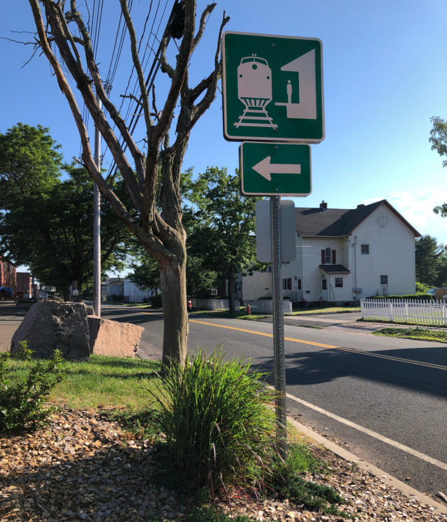
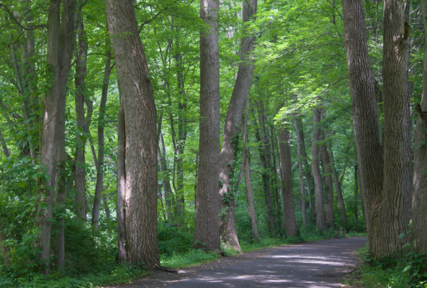
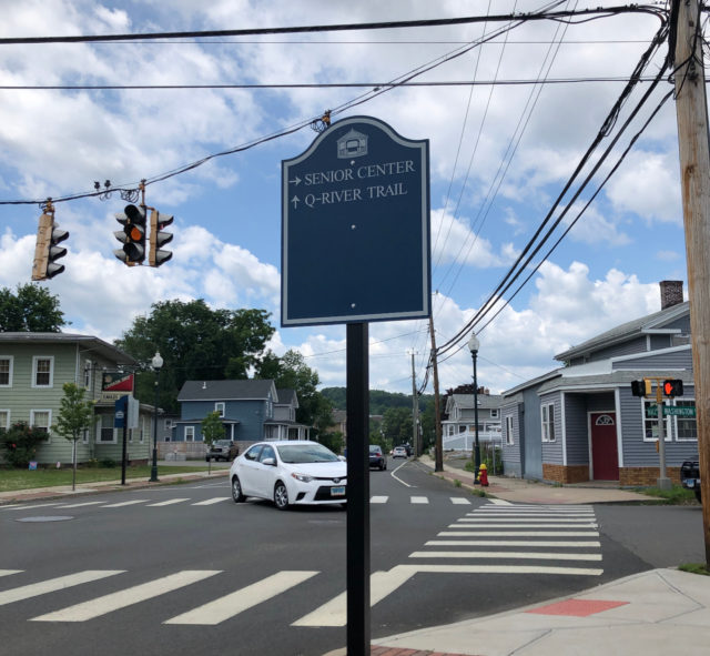
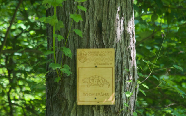
It’s mostly flat, the 0.9 mile walk from the train station to the Quinnipiac River Linear Trail, and while there is sidewalk, the section along Route 150 could be more pleasant. If cycling, I would ride on the sidewalk to avoid becoming roadkill at the hands of someone eager to get on the Wilbur Cross Highway Parkway, the entrance to which is just beyond Community Lake Park’s driveway. An immediate right puts you on the paved Q-River Linear Trail. There is no shortage of signage, some more useful than others due to weathering.
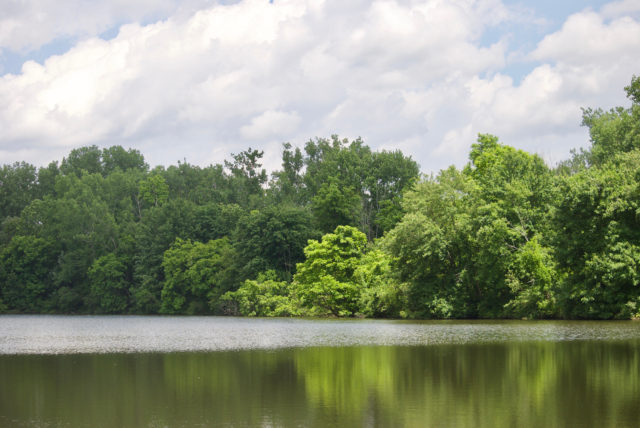
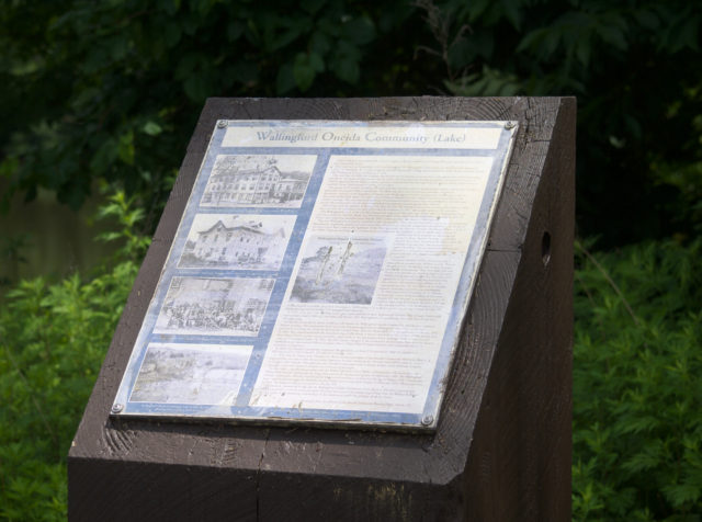
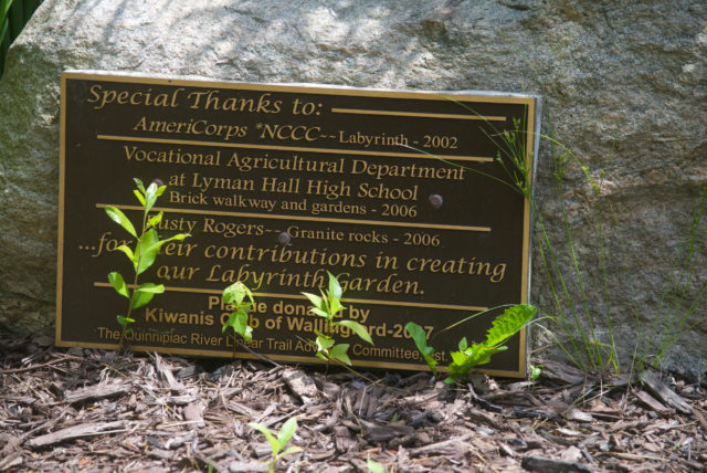
The first body of water is not the Quinnipiac River but a lake. There’s an entire plaque explaining the Oneida Community’s commune which is probably common knowledge if you live in that area of the state.
This first part of the trail is wedged between what looks like a standard town park and this pond/lake. On one side, all the stuff that doesn’t excite me but other people love: sportsball fields, a pavilion. On the other side, a kayak launch, milkweed, and lots of red-winged blackbirds.
As it loops around to another trailhead — the one people where people driving in would be more like to begin — there is a Little Free Library, working water fountain, and several portapotties.
There’s also another sign that tells you about where you are:
The trail answers the question where are all the people in Wallingford. I found myself asking that as I walked from the train station and saw only two people walking or cycling in nearly one mile; one of those two was a postal carrier. Yikes. I had begun to worry that I was headed someplace that would feel deserted and creepy, in a bad way.
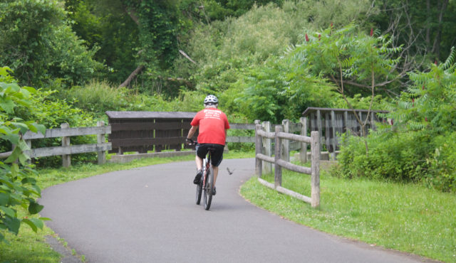
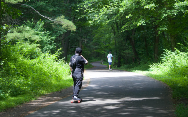
Turns out, the trail gets a fair amount of sneakers on it.
And bicycles.
And skateboards.
And bunnies!

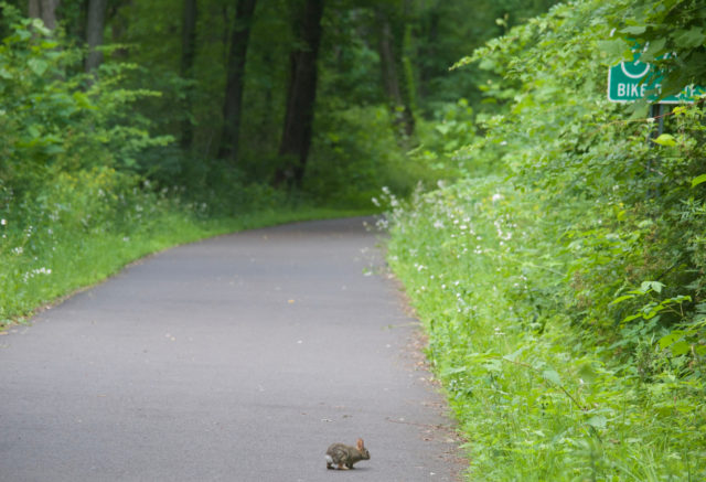
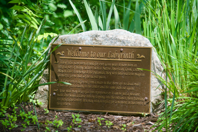
Oh, what’s this?
Another rabbit!

This tiny one was relaxing in/on the labyrinth.
It’s not fair, but I will always be disappointed by labyrinths because I developed slightly unrealistic expectations at a young age regarding what they should contain.
The rabbit is nice, but it’s no Goblin King.
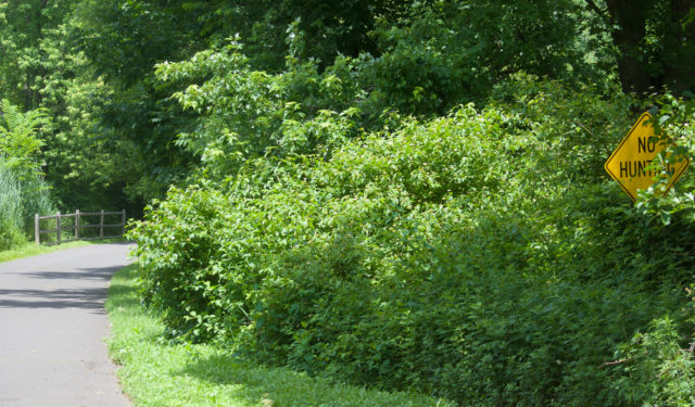
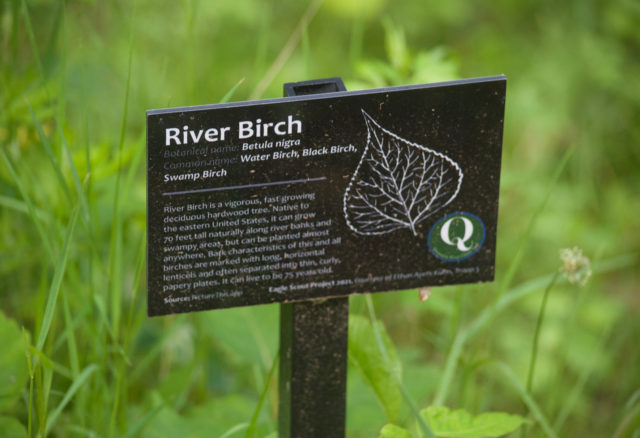
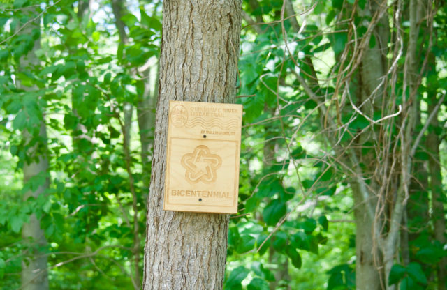
You guessed it: there are signs galore.
Want to know what kind of nature you’re looking at? There’s a sign for that:
Want to know how far you’ve walked? There are markers every tenth of a mile. Ignore the websites that say this trail is 1.25 miles long. It’s been expanded since, but the good thing about paths like this is that it’s nearly impossible to get lost.
Unless. . .
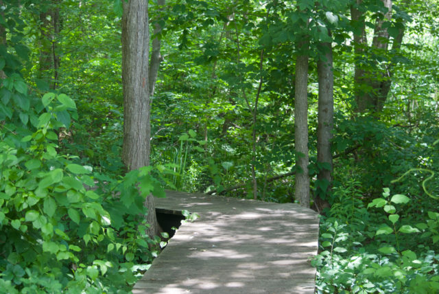
Unless you can’t resist a boardwalk and find yourself on a side trail that is a bit overgrown, maybe looping, and definitely filled with poison ivy.
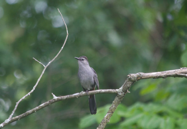
Regardless of (or because of) the possibility of getting lost, it’s worth exploring, if only because it is a little more distant from the highway noise and it’s quite the place to see and hear birds. These are wetlands. It was dry and early in the season, and I encountered no mosquitoes. I don’t imagine this is always the case.
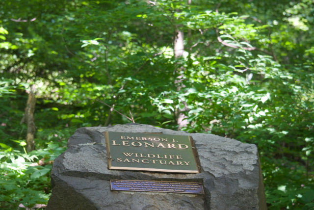
There were signs for this area also:
Along other trails in Connecticut, I’ve seen painted rocks with upbeat messages on them.
Here?
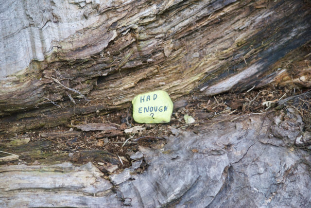
It was a well-timed existential note given the day I was here — the day that I and many others lost our legal rights as humans. I came here to distract myself, momentarily, from that.

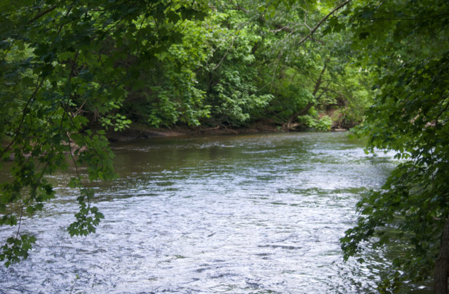
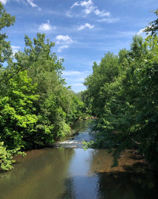
Columbine and foxglove line the path, especially after crossing the river.

Where is the river?
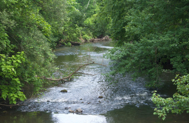
It’s about a mile on the paved path. If I bothered to take note of the mile marker, I could tell you the exact location, but what fun would that be?
There are plenty of benches along the way, and parts of the trail are lined with crushed stone, which I’m not sure if you’re supposed to walk on, but if your feet are tired from being on a very hard surface, there’s an alternative.
Visually, this is an attractive trail. I would return with my roller skates. But, I’d also bring my earbuds next time, or hope that the highway was closed for construction because it is quite loud — and I say this as someone who is used to walks next to the Interstate.
What else is there to do besides roam around the woods and sneak up on rabbits?
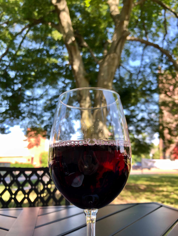
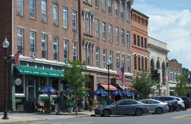
Drink wine at a former library.
The Library Wine Bar & Bistro had been on my to see list for awhile. I kept postponing for what should be obvious reasons, but when I found out they had outdoor seating, I moved it higher up on that list. I knew I’d at least get to peek inside, even if I would be eating al fresco.
There are more casual restaurants in Wallingford Center, though I am proof that you can show up in a Princess Leia t-shirt and be served without snobbery at the most upscale-looking place here.
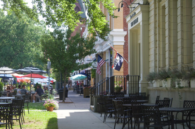
Don’t judge this area by Google Maps. What was another lewd amount of parking has been partially converted to outdoor dining for several restaurants. They could expand seating even more. The tables that are empty are outside of a restaurant that had not opened yet for the day. These were mostly filled within the first hour, very early on a Friday evening, which is when one eats while traveling solo and trying to be conscious about not taking up a large table on what’s probably the busiest evening of the week, but also, not being afraid to claim space.
It was obvious that I could have seen more, had it been a less humid, soul-sucking day, but there was enough here to fill a few hours, making it feel worth the trip down from Hartford.

It’s definitely one of the sleepier places I’d spent time in, but sleepy isn’t the same as dead. I visited during the week when Wallingford was celebrating its 350th + 2 anniversary and had special events planned.
And I can appreciate that at least part of the town was not stroads and strip malls, national chains, and cookie cutter design.
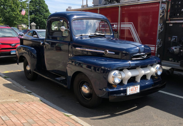
There was even one pickup truck that I didn’t want towed to a junkyard.
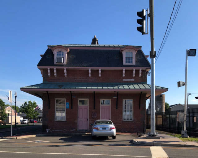
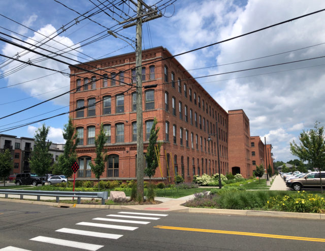
It’s hard to tell at a glance if the town has seen the growth that others along the Hartford Line have, and “seen the growth” is a passive construction. Is Wallingford embracing transit-oriented development? I was not left with that impression, though it looks like they might do something with the old train station. Maybe.
To visit Wallingford, exit at the Wallingford Station train stop on the Hartford Line. There are a few CTtransit buses once in town: 215, 291, 292. You can ride the 215 bus from the North Colony Road side of the train station; the 292 bus stops at the corner of North Cherry Street and Parker Street.
Greg & Judy Secord
Our son, daughter in law and two grandkids live in Wallingford. We appreciated you sharing your experiences there. We look forward to sharing your journey with our grandkids.