A Bicycle Roadtrip
West Hartford’s Canal Road, if you can get to it, is a joy.
It dumps out on a blind curve on Albany Avenue, which is like a racetrack where winning simply means you haven’t been involved in a ten-car crash on the mountain.
The mountain, by the way, is Talcott Mountain. Not Avon.
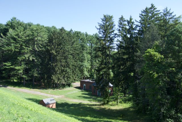
Canal Road begins as a path near Hartford Reservoir #5.
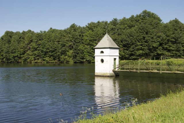
I have a love-hate relationship with “The Reservoir,” mostly because the paved paths and abundance of convenient parking means that the recreation area is overrun by people. People walking their dogs. People who have inserted earbuds and lost all sense of spatial awareness. People pushing strollers, side-by-side,by-side. People having boisterous gossip sessions.
It’s at once being in nature, and feeling deprived of nature.
But it’s hard to dispute the beauty of the lakes, nestled in rolling hills. And with a little extra effort, it’s possible to put some distance between yourself and the uber social part of the park.
First, take the paths that are not on the maps, that require going away from the parking lot. Remember: pavement = people. If you’re on a trail that is dirt or stonedust, there are going to be fewer users — at least in this part of the country. The willingness to duck on and off the main paths is a healthy medium, where you are rewarded with both the views and the solitude.
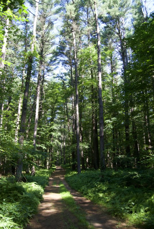
And this is how you find Canal Road.
For a moment, it acts as a glorified driveway, but otherwise, is a cyclist and pedestrian path that parallels a portion of Mountain Road. If someone cared enough, they could find a way to create a safe crossing from there to Ferncliff Drive. The idea of this is in West Hartford Bike Master Plan (more on that later), but like most plans, it seems to be doing nothing more than collecting dust on a shelf.
For now, it’s a way to meander by a mix of older houses, as well as the mcmansions of the nouveau riche, complete in a few cases, with yards that have been denuded of nature. Why, pray tell, would one go into a more wild part of town only to strip out the trees?
This was once a site for drag racing, but it seems that barriers have stopped that activity. At one time, there had been a proposal to stick I-291 between Canal Road and the reservoirs, with the town planner in 1959 believing that this route would be scenic for motorists and more practical than if it were developed west of the reservoirs. Thankfully, the landscape was not wholly handed over to the highwaymen.
Canal Road is not the most beautiful place in West Hartford, but it is something to see, and to think about. Where did the name come from? Why is walking and biking treated purely as recreation in this town? Riding along, I think about how whole sections of Asylum Avenue are without sidewalk. How we have built this culture of driving to recreation areas.
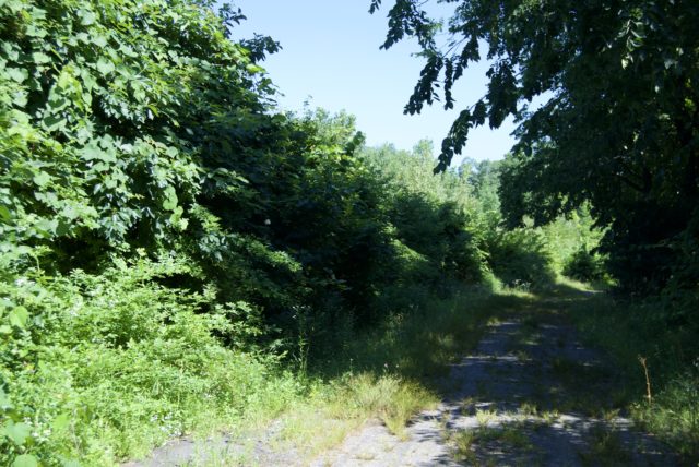
Although Canal Road does not parallel the full length of Mountain Road, the other benefit of this path is that there are fewer obstacles on it. In the time that I would have passed upwards of fifty people doing a loop around the reservoir on Route 4, I saw exactly two people and one dog.
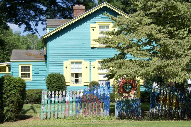
As mentioned, crossing over Albany Avenue leaves a lot to be desired, but if you don’t die, you’re in a residential neighborhood with a slight hill. This not-so-obviously connects to another neighborhood of cul-de-sacs, where you are blessed with a downhill ride to Mountain Road, where if you are like me, you are so distracted by this house that you never see the entrance to the Wintonbury Land Trust trail that you even came here for. Oops.
Mountain Road feels dicey. If you’ve ever been on it, you know that people drive far too fast for the street. It does not feel like what one should find in a Bicycle Friendly Community, or in a town neighboring one. Every time I am on it, I have to wonder where people are rushing to at such speeds. What about this narrow, windy road yells “hurry up!”?
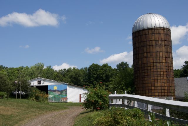
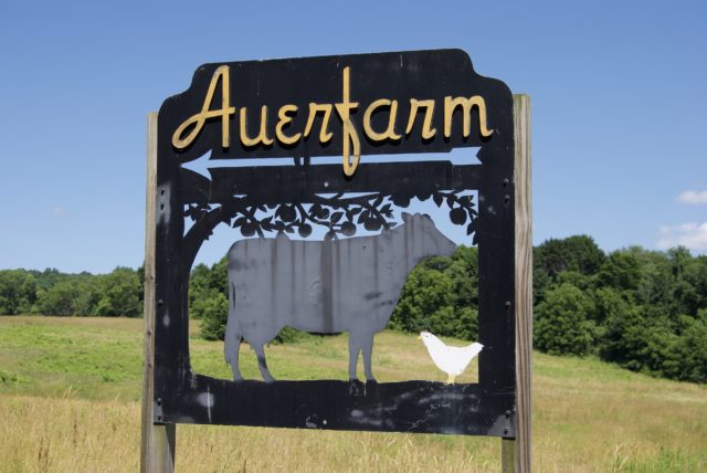
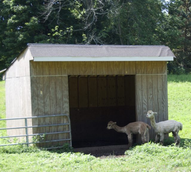
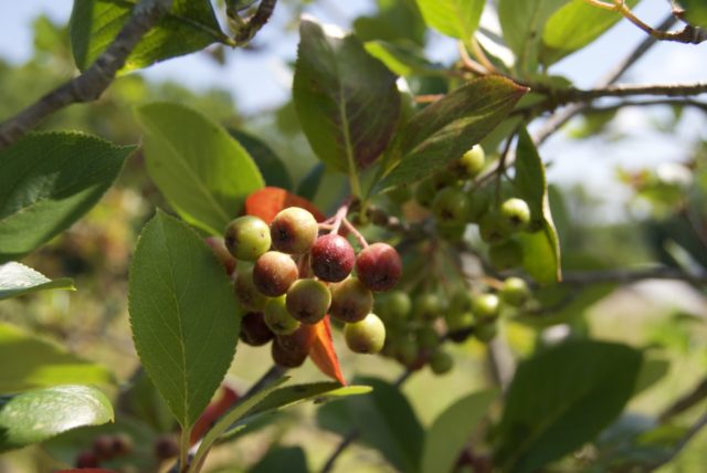
Auer Farm, just down the road and up 185 before it gets absolutely terrifying, is on a long gravel driveway. It’s not accurate to say that farm animals will greet you. They were more interested in eating or climbing into their sheds for refuge from the sun. Eleanor Roosevelt visited Auer Farm back in the day, and if it was good enough for her, then why should it not be good enough for me? There are pick-your-own blueberries. Gardens to wander through. Picnic tables placed in the shade.
From here, you could attempt to continue on 185 toward Penwood State Park, but this road is hilly and filled with entitled motorists who like to honk and pass too closely. I would advise against this unless you’re one of those vehicular cyclists who can actually haul ass, or maybe if you have an electric assist on your wheels. In the meantime, ask the State Department of Transportation why they do not install bike lanes on the route, where there is absolutely space to do so and undeniable demand for this as a safe route.
By the way, electronic maps might show what looks like access from back roads to Penwood. If those connected before, they no longer do. Don’t waste your time riding up another steep hill.
Instead, pick a few back roads to get to Duncaster Road in Bloomfield. You might still get honked at here by an aggressive driver, but there are fewer cars in general to contend with and they can easily pass and get over their so busy and important selves in the process.
It’s possible that instead of angry people, you’ll only encounter a deer with little antlers. Look for a red barn on Duncaster Road — this is another property of the Wintonbury Land Trust.
At a glance, it’s not really clear what is going on with Hawk Hill, where there are allegedly Scottish Highland cattle on site. When I arrived, they appeared to be hiding, and it looks as if the WLT is working to fix fencing. A few signs to clearly explain what’s going on here would be awesome.
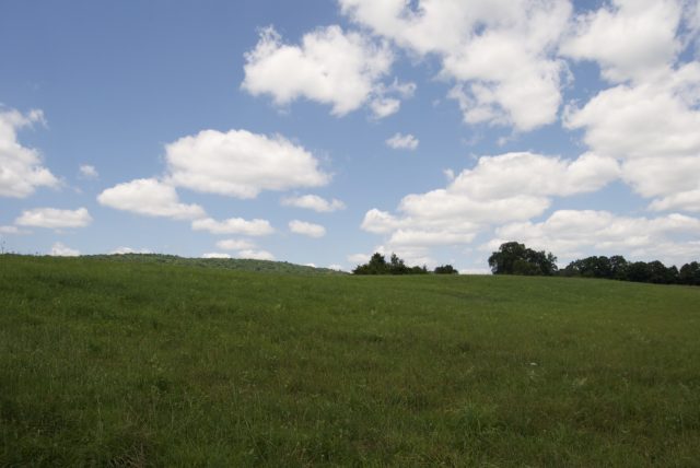
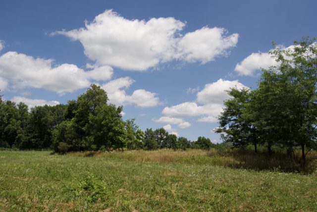
Still, it’s not a wasted trip. There are hiking paths that take you to large, open fields that make you grateful that the land is being preserved, rather than converted into yet another soulless subdivision. There are clear views of the Metacomet Ridge, and of a farm down the road where you can watch cattle wade in a pond. The paths are overgrown in places, with yellow sweet clover and devil’s bit. Because there is any effort involved to hike the property, it’s unlikely you will run into many people.
Because connectivity between West Hartford and Bloomfield to Hartford leaves a lot to be desired, I’m going to leave that part up to the imagination of the reader.
Is this post filled with irritation? Absolutely, yes.
You know where you stand in the pecking order as a human when the modes of transportation that you use are not prioritized — when it’s called “progress” if a town takes over a decade before getting around to installing a bike lane at the expense of a sidewalk.
That’s happening, by the way, with Mountain Road.
In 2007, West Hartford created a Bike Task Force with the intent that they come up with a (seemingly undated) Bike Master Plan.
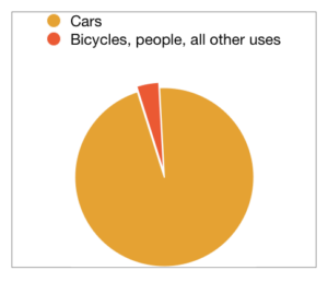
The plan is refreshingly biting. It’s honest and urgent. They dared to publish that 92% of those they polled said that West Hartford was not doing enough to encourage cycling: “West Hartford, unlike surrounding towns, has no bike lanes, no bike paths, no bike signage, and few bike racks. Many of the roads provide no room for cyclists. And recent road improvement projects have failed to accommodate the needs of cyclists. Riding a bicycle on any of the major thoroughfares in West Hartford is a hazardous activity for any cyclist. […] Some have been designed to move as many cars as possible as fast as possible […] leaving no room for marked shoulders to offer at least a perception of a safe zone for a cyclist.”
West Hartford’s plan acknowledges that the less expensive, low hanging fruit improvements have also posed challenges for the town, as the bike racks have been “sporadic, and consist almost entirely of the slot-for-the-front-wheel-type bike racks, which are not recommended. The known exception is the inverted U type at the Bristow Middle School. Blue Back Square has installed, albeit improperly, three bollard/loop type racks in the south garage and three behind Crate & Barrel, providing storage for six bikes. As a proportion of the capacity of the garages (1,026 cars) these six racks are too few.”
There have not been substantial improvements in the years since this plan has been released. In 2016, a Bicycle Facilities Plan was adopted. There have also been studies of the Bishop’s Corner area. When in doubt, conduct infinite studies and keep making plans.
The plan does suggest extending Canal Road, as a path, to the mall area and then to Stanley Park in New Britain. This seems reasonable, as would narrowing Albany Avenue and installing barrier-protected bike lanes.
Those who created the Master Plan threw up their hands over Canal Road, saying it would be an “out and back” (a recreation path, rather than something functional) because “there is currently no safe way to cross Albany Avenue,” which seems to me like giving up too early on an opportunity to challenge the CT DOT. Just because something is a State road does not mean it’s destined to be a dumpster fire.
All I’m saying is that when they did the big renovation of Route 44 a few years ago as a reaction to a crash with multiple fatalities, they could have kept the curves and installed more stoplights.
The facilities plan, however, shows some sort of movement to adding a connection across Albany Avenue, that would then cut into the reservoir that straddles West Hartford and Bloomfield.
Other trail possibilities were considered in the Master Plan, from installing one along the I-84 right-of-way from Park Road, east to Hartford, to creating one along the North Branch of the Park River, which would connect to one they said was being planned within Hartford. The trouble with that — though I guess at that point, West Hartford wouldn’t have to deal with it, so not their problem — is that the North Branch Park River crosses below Albany Avenue; there is still the State Road Dumpster Fire to contend with, unless one wants to build an utterly useless trail that offers no connectivity. Then, you have to ask yourself if removing those trees and manipulating the landscape is worth a bike path, or if they could not just take existing roads and modify them to be safer for all users. The sensible thing to do is make use of the pavement already in abundance, and revise what our cultural priorities are now and for the next few decades.
And those are the thoughts one has while pedaling through Hartford’s north and west suburbs, wanting to simply disconnect and enjoy nature for a few hours at the end of the week.

Tim
Glad that Real Hartford is sharing these forays beyond Hartford. I always say “If this were L.A., we’d still be in L.A.,” there would not be these mini-suburbs. It would all be Hartford!
Regarding Bloomfield, there is a Complete Streets process that has begun. I’ve been to a few meetings and there is progress in developing the “plan”. Also, there are real plans and real action taking place in building multi-use trails as part of the East Coast Greenway. Pavement is down already in the North End of Bloomfield with the first phase due to be done later this summer. The remainder will take more money and more years, but those working on it have it in mind to get the trail close to Hartford, at least to the University of Hartford as I understand it.
Regarding nice spots in Bloomfield, for those of us who love a nice view of the Hartford skyline, two of the closest to Hartford can be had in town. The first is in the newly created Auer Farm State Park (access same as Auer Farm but head up the hill through the old orchard). The hilltop has some nice views. The second, and best view, is on top of Hawk Hill that can be accessed via the Hawk Hill Farm that you mention (head up the trails/roads behind the barn) or via the Lasalette House ( https://www.facebook.com/pages/Lasalette-Open-Space/320412855403496 ).
The Great Outdoors: 26 Places You Can Reach By Bus, Without Fuss, From Hartford – Real Hartford
[…] West Hartford Reservoir: “It’s not the worst.” Whether you want to run into everyone you’ve ever met or duck onto […]