A Bicycle Roadtrip
If you don’t need to see and be seen, nor collect machismo points, then you can have a pretty good time taking a bicycle roadtrip just south of Hartford on a lazy weekend afternoon. Though Wethersfield and Rocky Hill are not designated as Bicycle Friendly Communities, that should not discourage you. For whatever reason, it actually seems calmer to ride here than in some of the towns that have received that recognition.
Start by going south down Campfield Avenue near Goodwin Park. This quieter street turns into Folly Brook Boulevard at the town line. It’s a flat route, perfect for cyclists who don’t ride often and who don’t care about anyone’s Strava segments. You’re likely to see groundhogs and rabbits nibbling along the roadside even before the street becomes a path for pedestrians and cyclists. You read that right. In the middle of town, the car is not king for a mile or two. Enjoy the novelty of a slightly shady stonedust path that has somehow not become inundated with people traffic.
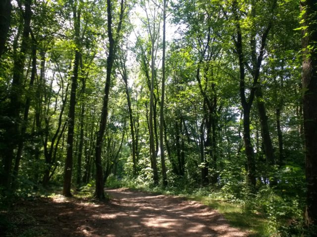
The path will take you through Wintergreen Woods. If you opt to explore, you can go off the Wethersfield Heritage Way Bikeway Path (henceforth, referred to as the Heritage Path). You’ll know you’re in the spot as it opens up to a small clearing with a parking lot where you’re apt to see at least one person doing something shady in a parked car. The posted map is currently hard to read due to someone’s compulsion to paint “Panzer Division” over it, so if you feel like a map is necessary, grab one off the Internet. (P.S. Could someone modify that scrawl to say Pansy Division? Thanks.) Wintergreen Woods, which had gone by “Folly Brook Park area” for a time, is only 110 acres. Honestly, unless you’re starting your walk close to sunset, you can probably do without any wayfinding beyond the markings on trees.
Starting in the 1960’s, there talk of “improving” the park. For those who have not gone deep into 20th century development trends and the language that went with it, the term “improvement” nearly always turned out to mean the opposite: superhighways, buried rivers, the works. Plans for Wintergreen Woods included walking paths, a pond, nature center, amphitheater, and cabins. Not all of those ideas materialized, though a swimming pool did get installed in the middle of the park.
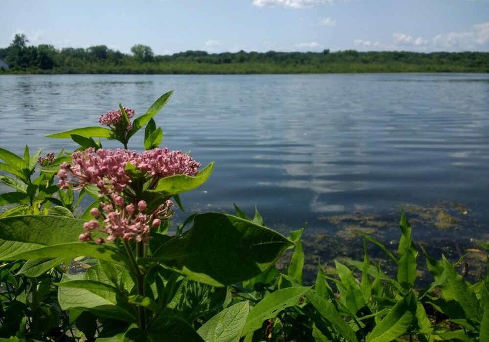
The paths range from woodchips to hardpacked dirt to pine needles with a series of roots sticking out of the ground. You might want to lock your bike and check out this area on foot if you’re not into obstacles. The woodland blends into marsh and then back again. There is a small algae-covered pond with croaking frogs. Minnows and pollywogs swim in the brook.
After completing the loop trail, get back on the Folly Brook Boulevard stonedust trail. In a bit, you’ll be guided by a green “bike route” back onto a local street. Unlike some of the other bike routes I have experienced, this does not throw you into a veritable traffic sewer!
The next stop is Mill Woods Park, which hosts the Eleanor Buck Wolf Nature Center, a swimming pond, and a dog park. This is a suitable stop for a picnic in the shade, and if you’re timing is right, a visit to an ice cream truck.
Finished? Keep following the bike route signs past playing fields, up onto Griswold Road and Highland Street. Now in Griswoldville, the housing gets more interesting. So far on this route, Highland Street is the most challenging, with a long, gradual hill. About one minute after conquering that hill, the road curves left. Follow that, then start looking for the entrance to the 1860 Reservoir on the right.
This land was apparently used for livestock grazing in the 1600’s, but was later modified to power gristmills. It’s been called the Griswold Reservoir, and briefly, Higman Lake. In 1908, it seems to have changed owners, and the changes at the site were not embraced by the locals. A dam was built, which pissed off farmers in Wethersfield. Instead of waiting around for legal remedy, the farmers tore the dam down. It got fixed up. They went and broke it again.
By the 1960’s, the town of Wethersfield decided that they should have more open space and a way to both retain storm water and have a reserve for the swimming pond at Mill Woods Park, so began planning for the purchase of these 67 acres. Since then, there has been application of herbicide to the water and dredging to help restore non-invasive life to the pond.
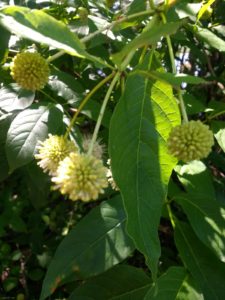
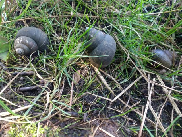
It’s unclear why such a large parking area is maintained for this spot, especially since the remnants of illegal dumping and littering are in view where vehicular access has been permitted. The trail continues past giant concrete blocks, and the trash problem almost immediately stops at that point. If you look along the reservoir’s edges you’ll see Buttonbush. Snails are plentiful.
Also plentiful: poison ivy after the bridge. Up until then, the path is reasonably maintained.
If you’ve ever said to yourself “I’d like to go to the reservoir, but I don’t want to deal with all those noisy people,” then the answer might be to look south instead of west to fulfill your reservoir wishes.
Here, you can go back the way you came or start to improvise. I vote for taking out the phone and looking for a few residential streets that will take you into Rocky Hill to either drop by Dinosaur State Park, or bypass that in favor of Ferry Park in Rocky Hill. Look for Route 160 and then the brown signs indicating an historic ferry. If you have all the time in the world, go ahead and hop across the river. If not, there is a picnic area and a seafood restaurant. From here, go into what looks like an unpaved parking lot, then head right where there is a gated path.
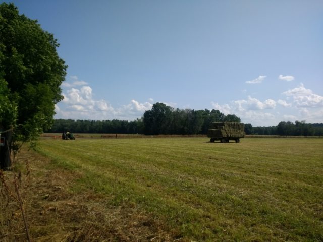
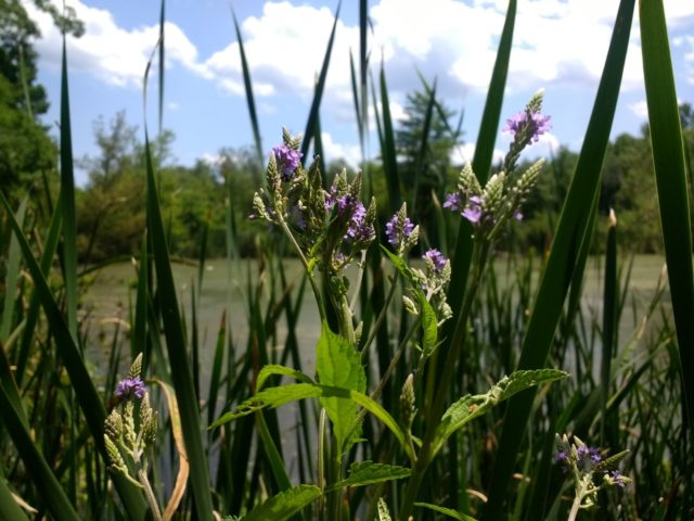
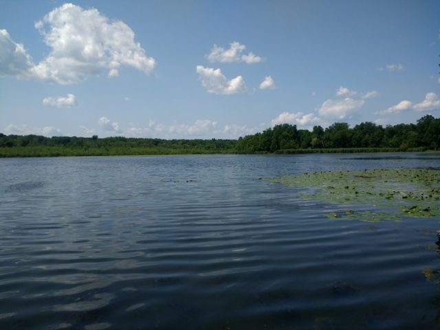
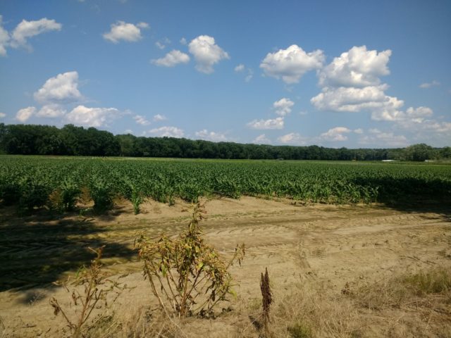
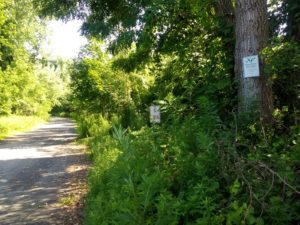 This gives you entrance to the Great Meadows, a place where bicycles and pedestrians are welcomed, but most motor vehicles are not. Signs remind visitors to stay out of the farm fields, where you can see corn and beans growing at this time of year. Watch for tractors and other farm vehicles. It can get dusty in the open field area, and is just more open to the elements in general, but the path switches from woods to fields and back again. “Important Bird Areas” are posted and you’ll see birdhouses along the stonedust and traprock path, which is also part of the Heritage Path. There are occasional glimpses of the Connecticut River, and if it’s warm and sunny, you’ll probably hear jet skis and yacht rock.
Exiting the Meadows is jarring because you’ll find yourself not in a lovely boatlaunch park, but by a strangely placed highway ramp and an office park. If you need your glass half full, it’s that there is a restaurant with a river view within that office park.
From here, you can wind through Old Wethersfield and stop for ice cream or hang out at the Cove. In an ideal world, you would be able to hop on a bike path atop the dike in the South Meadows and have a safe and scenic route back, but we do not have that yet and I encourage readers who are interested to contact Hartford’s Department of Development Services with the question of why this has not happened.
Until that does, you can exit via Hartford Avenue in Wethersfield, which is a decent ride until it flows into Wethersfield Avenue in Hartford, where there are no bike lanes until the Elliot Street area. Or, you can finish the Heritage Path meander back to Folly Brook Boulevard.
See Heritage Path map for more information.
Kevin Sullivan
Nice article about the Heritage Way Multi-UseTrail! By the fall, the map will be published on line to integrate with Google maps, and QR codes will be posted around town to link to the map. The QR code will also connect to the Heritage Walk map – a history-oriented walk in Old Wethersfield. We also are working to make connections between the Heritage Trail and Hartford’s South Meadows / Riverfront / Colt Heritage Park, but that will take some time. Kevin Sullivan, Bike Walk Wethersfield