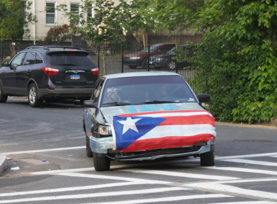
Instead of screaming into the void of Twitter, I bring you a weekly highlight reel of what it’s like going places in Greater Hartford when one is gloriously car-free. These posts are on a slight time delay because nobody needs to know exactly where I am when I am there.
I recently wrapped up the #BeyondHartfordBeyondCars Summer 2022 tour — train and bus day trips to different parts of the state, and am processing all of that. (Trips included: Old Saybrook, Clinton, Mansfield, Simsbury, Manchester, Branford, Guilford, and Wallingford)
It would be beneficial to our systems both if transportation planners took public transportation to their jobs, or anywhere, at least once a week, and if they regularly took trips this way to other locations in state without assistance from co-workers. In other words, the people with the most control over our systems need to have more organic experiences with how our systems work. Similarly, I don’t advise walk audits when people do them in groups larger than two or three people, nor when participants are swaddled in hi-vis or being assisted by traffic police. These conditions do not reflect daily, real life experiences.
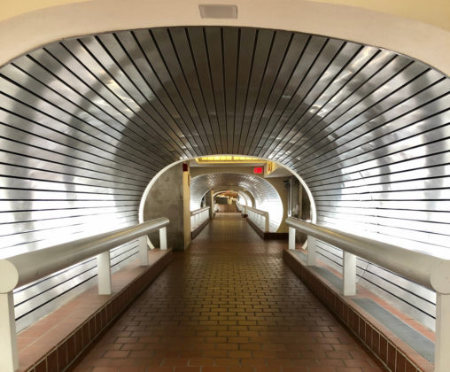
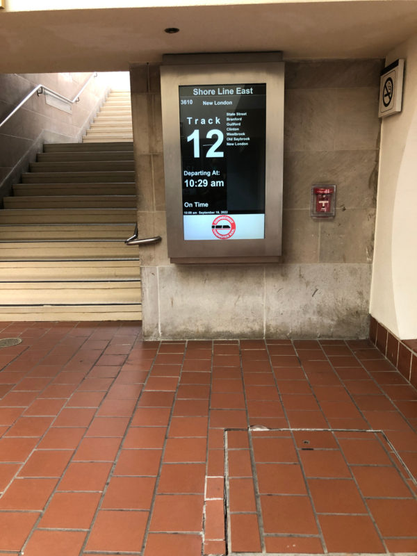
Not enough planners use the systems. Not enough planners take into account what it’s like to ride a bus or train with fresh eyes. How does someone who has never taken this route, or taken any train or bus, know where and when to board? If the answer is “on this app,” how do they know to look there? What about riders who don’t have smartphones? One of the most annoying features of these summer train trips was figuring out where to board. Hartford’s Union Station has instructive signs telling passengers that everyone uses the same track. There is a sign with arrows pointing toward Springfield and New Haven, so you know which direction a train is headed in. Both stations in New Haven have multiple electronic boards posting train numbers, destinations, times, and platforms. But when it comes to the other stops? It wasn’t always obvious. Shore Line East stations — some, not all — post paper schedules with track assignments, but the location for these paper signs was not standardized and on much smaller paper than reasonable. It made me wonder if there were outmoded community standards for things like tag sale flyers that got applied to transportation schedules. Other explanations I’ve speculated on: they only have budget for 8×12 print outs, the intern tasked with posting these has perfect eyesight, or they’re checking a box without concern about user experience.
This is not merely my own anxiety speaking. At several stations, I observed or chatted with other passengers who could not figure out which platform they needed, and who were worried because trains do not run frequently, and it’s not like we’re birds who can flutter to the other platform at the last minute when the train is in sight. You have to go up a flight or two of stairs, cross a bridge, and then descend; or, you have to wait for an elevator. Is the train going to wait for you to cross?
Common sense would say that eastbound trains use one track and westbound trains use another, and if you can figure out simple directions, then you know which way to go. This is not how trains operate, though, and even when a noon train is scheduled for track 3, there might be a change. You have to know to check your phone for alerts. Sometimes the station provides platform change information, but on a recent Shore Line East trip, the station signs and announcement gave a different platform from where the train arrived. None of those changes were noted on Shore Line East alerts. It was lucky that this was an easy fix for the dozen people boarding.
I think a lot about this because it’s one of the simpler things to fix. This isn’t adding more trains or employees, building platforms, electrifying the Hartford Line, or doing anything else sexy and shiny, which is probably why it does not seem to be part of the conversation. Planner people: do what you need to do to set the mood, I guess, and go evaluate the stations solo, in partners, in a large group — mix it up. Will someone taking the train alone for the very first time know how to get to platform and which one? Are these signs posted at every entrance?
It might not make sense to install the level of signs in smaller stations (Branford, Old Saybrook, Wallingford) that are at major stops (Hartford, New Haven), but that does not excuse inconsistency when delivering basic information.
Then, the stations should think about wayfinding for those exiting. Does the train exist to deliver people to their cars or to a town? It’s not the former, and while I can acknowledge that having some signage sending people to the parking lot (which is always super visible and completely surrounding the station, impossible to miss) may be acceptable, I want to know how you are instructing visitors to reach whatever the nearest main street is. Most older stations were constructed in or close to what is a town’s historic area, which is often where the local stores are. These are attractions! Do you want my money or not? How difficult is it to create and install several signs as simple as “Main Street” or “Such and Such Town Green” with arrows? Having an area map posted at the station, like what you can find on the east side of Hartford’s Union Station, would also help, and it seems like a Chamber of Commerce project.
We have to stop thinking of trains and buses as existing only as commuter services, or as what gets us to New York City. Connecticut spends money on tourism campaigns, but somehow forgets that transportation is required. . . and in a time when public transportation should be prioritized as a way of reducing carbon emissions.
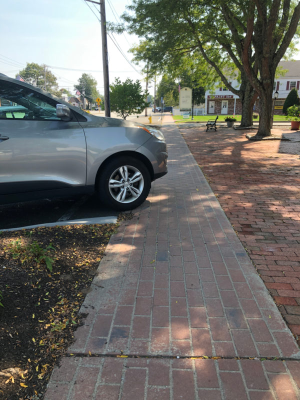
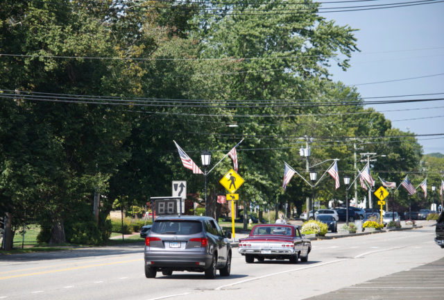
Something else I noticed was how poorly designed main streets, besides being dangerous, sucked the charm right out of some towns. Old Saybrook and Wallingford stand out in this way. Both have prioritized LOS (level of service — moving cars through speedily) over all else, and it detracts from gems that can be found there. The above photo was taken in Old Saybrook. I was and am astounded by how many vehicles I saw beached on the sidewalk. Is there an ordinance against using curbs, planters, or rocks as barriers between parking spaces and human spaces? Why is the town facilitating situations where drivers can easily hit a person walking or cycling on the sidewalk? And that’s where most people were riding in Old Saybrook — on the sidewalk.
Why am I going to linger in a place where every space has been handed over to cars? I’m not.
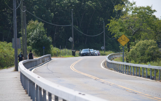
Another observation: if you are able to ride a bicycle, you can potentially expand your trips by bus and train substantially, but there’s always a catch. The obvious one is in our missing infrastructure. Without an electric assist or super fast legs, lots of the streets around train stations and bus stops are not places a person wants to be on a bicycle. The photo above shows a causeway. Some people biked in the street; a few used the barrier-separated space. But to reach this, one would have to manage that stroad between the train station and here. The state has plenty of nice separated bike paths. It’s a matter of safely getting to them.
That’s not the only catch. How do you get your bicycle on the train? It’s just as hard in some stations to find where the elevators are due to poor signage. There’s no extra charge for bikes on CTrail, but there is for Amtrak, so you have to pay attention to which train you’re using in addition to just what works for your schedule.
Not all bikes are permitted on buses and trains though. Amtrak has a 50 lb weight limit, which rules out some cargo bikes. CTrail does not post a weight limit, but says bikes are limited to standard or folding. I’d be surprised if that’s enforced by CTrail, but it’s something to keep in mind. I’ve been told that cargo bikes do not fit well on the front of CTtransit buses. There’s also the possibility that both spaces on the bus rack will be taken and you’ll have to wait for the next bus.
There’s also this sense that you’re supposed to somehow magically know how to secure a bicycle on a train or bus, which is stressful and I know because I’ve received people’s texts and emails about how anxious they were about boarding with their bikes. You don’t want to hold everyone up, but you also don’t want your bike to go flying off the front of a bus. Not everyone has a lot of upper body strength and any kind of rack scenario involving lifting a bicycle can seem intimidating or unwieldy.
Trips to Simsbury and Mansfield especially got me thinking about bus design. You can wheel your bike onto a CTfastrak bus, but can’t do that for the regular or express buses. I’ve also been noticing on regular bus trips how crowded, awkward, and stressful some routes are because the buses do not comfortably accommodate multiple people with mobility devices, shopping carts, or strollers. I don’t want to make this all about that generation, but nobody’s getting younger and there will only be more demand for space. Why not design in a way that assumes most passengers need more space, and then leave the very back of the bus for the tight seating?
The major positive lesson from all this has been that you can get off at New Haven’s State Street Station to pick up Shore Line East if you feel like it. The “you can’t connect to other trains” message is simpler for conductors to share than something nuanced, and as I’ve been told, every day they still have someone who needed to be at Union Station getting off the train early despite repeated warnings. Somehow, I have never been that person.
Why would you want to do that? Depending on how much time between trips, you might want to stop at a shop or restaurant. The ticket price for either State Street or Union Station are the same, and sometimes I make this decision based on how late the first train is running or if I’d like to use stationary indoor plumbing before getting on the next train.
Otherwise, this experience reinforced for me much of what I already knew: you do not need a car to exist or thrive in Connecticut, and you do not even need one to get to the beach — unless you had your heart set on Rocky Neck or Hammonassett. There were far more places I wanted to visit than had time to. Some of that was the train and bus disruptions over the summer, and some of that was my own schedule.
All towns and transit systems have space for improvement, even if their residents and employees don’t want to hear that criticism. Some, like New Haven, have already taken major steps. Others, that shall not be named, don’t seem to have admitted to themselves yet that they have a problem.
THE SIGOURNEY STREET BRIDGE
Without warning it was entirely closed to pedestrian use this afternoon. Nobody’s arguing that the linework didn’t need to happen. But would it actually kill to remove one of the extra travel lanes from cars and let people walk and bike there when this stuff comes up? Didn’t appreciate the sudden detour in heels.
Dear Wethersfield,
If you don’t want hundreds of people and their associated vehicles having mass gatherings and doing burnouts on your roadways, stop designing your streets such that they accommodate this. How many unnecessary lanes are at Wolcott Hill Road and Jordan Lane? Instead of calling the police, call the Town of Wethersfield and ask how they are implementing Complete Streets policy.
WHAT NEXT
Go on the next Fill The Little Food Pantries ride on Saturday, October 1st at 2:30 PM, meeting at the food truck park on Farmington Avenue and Girard Ave. Bring non-perishable food and hygiene products to drop at various free pantries in Hartford. The ride ends in Elizabeth Park where people can stay for Night Fall.