Instead of screaming into the void of Twitter, I bring you a weekly highlight reel of what it’s like going places in Greater Hartford when one is gloriously car-free. These posts are on a slight time delay because nobody needs to know exactly where I am when I am there.
Believe it or not, I had things I wanted to do in the last week that did not involve going hard on the neighboring town’s government. . . but I’m sure that the pedestrian who was murdered last Friday had things he wanted to do as well.
I become less patient with people’s shoddy excuses for inaction the older I get, and when I hear from West Hartford apologists, I just can’t.
When I’ve asked why Trout Brook Drive is so terrible, I hear about how there was a road diet on North Main Street. Where?! Really, where? If it’s not obviously improved, I’m not feeling it was much of a diet.
And then there’s the bike path.
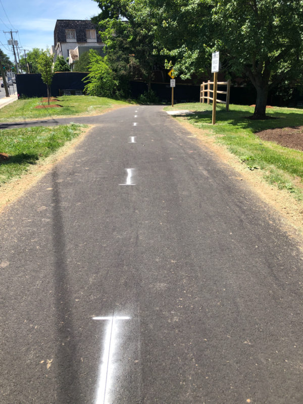
My first question will always be how do you get to it? Once on it, great. It’s beautiful. But most of its sections spits you out in a place that is not ideal for kids learning to ride, or for anyone.
The newest section goes along Trout Brook between Farmington and Fern.
How do you get across Farmington? Nothing has been done to improve the road. Was the thought that people would just live on this stretch of bike path?
Here’s a scenario for you: I want to visit with a friend who lives on one of the side streets between Trout Brook Drive, University of St. Joseph, Albany Avenue, and Asylum Avenue. How do I do this? Bus service is spotty in this part of town, and more so the later in the evening it gets. There is no sidewalk along portions of Trout Brook Drive. There is poor street lighting. Biking on Trout Brook Drive is not safe. Tell me how a pleasure path on the other side of the speedway that ends one mile away helps with that?
It’s hard for me to care about things that feel like shiny distractions from surrounding unresolved issues.
The photos below above and immediately below were taken when I got off the bus to meet up with a friend in the Center, days after the pedestrian murder, when this was truly the last place I wanted to be. I was greeted with yet another half effort — a bike path with unsafe street crossings in a “walkable” town center where cars are prioritized, in a town with painted bike lanes in which people park because they think their convenience is more important than someone else’s safety. The Town of West Hartford couldn’t have sprung for a few well-placed bollards for any of those painted bike lane? Couldn’t have dramatically reconfigured any of those lousy intersections people are asked to bike across if they want to use this scenic path?
A few days later, I learn about how a motorist drove his/her pickup truck off of South Main Street into a telephone pole, breaking it. A photograph of the truck shows it on top of the sidewalk between Boulevard and Park Road. If you design streets like race tracks, that’s when you wind up with a busted utility pole down the road from where four days earlier another driver took down a ped head and killed a pedestrian.
Why is this “pick on West Hartford week”? Because I’m not finding much to celebrate about a place that brags about how safe and walkable it is, while being not particularly either. They’ve had years to do studies and years to prioritize the safety of those in this town.
Anyway, there were places I lived before Hartord. One was New Britain. One was not West Hartford.
Over in New Britain and Newington, there’s a multi-use (biking/walking) path that runs for five miles along the CTfastrak route. There’s at least ten feet between users and buses, with a substantial fence serving as a barricade. Plus, bus drivers are professionals, so it’s already safer.
Here, cyclists can go for miles without interacting with motor vehicles. There’s a crossing on Smalley Street, East Main Street, and Stanley Street in New Britain, and cyclists can press a button to get green light to cross those two-lane roads. One section — East Street — puts you off the Fastrak for a bit and onto a less glamorous side path.
You tell me which path you’d rather let your kids and grandkids ride on.
The one in New Britain that has this crossing:
Or the one in West Hartford that has this road crossing:
It’s obvious.
I know. I’m not being fair to West Hartford, so here’s another place where the WeHa path requires cyclists/walkers to cross the road:
Sorry, I’ll let West Hartford have one more shot at getting it right. Here’s where its path currently ends:
You can tell me what you’re doing, or you can show me.
Anyway, ideally, the CTfastrak multi-use path wouldn’t end on Chapman Street in Newington, by the Newington Junction station. It would go to Hartford, at least to the end of the busway across from Union Station. It doesn’t do that, but you can safely board the bus with your bicycle.
And then what?
My current favorite activity is to bus/bike/walk to the Fenn Road Starbucks (Cedar St Station) and jet right in and out past the fools idling in the drive-thru line, (“pain at the pump” my ass!) then, wander on the path. It’s not the most scenic place in Connecticut, but for a quick mid-day break during the work week, it works.
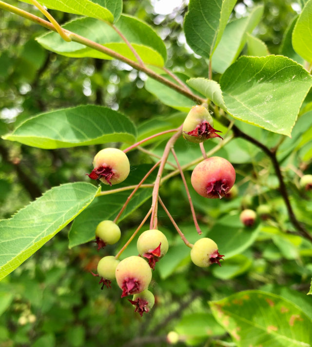
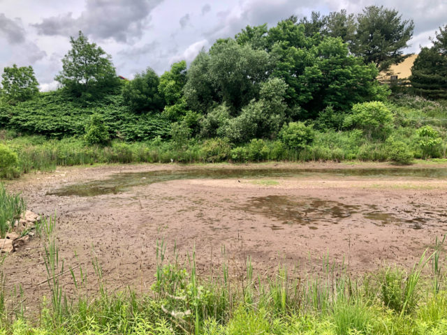
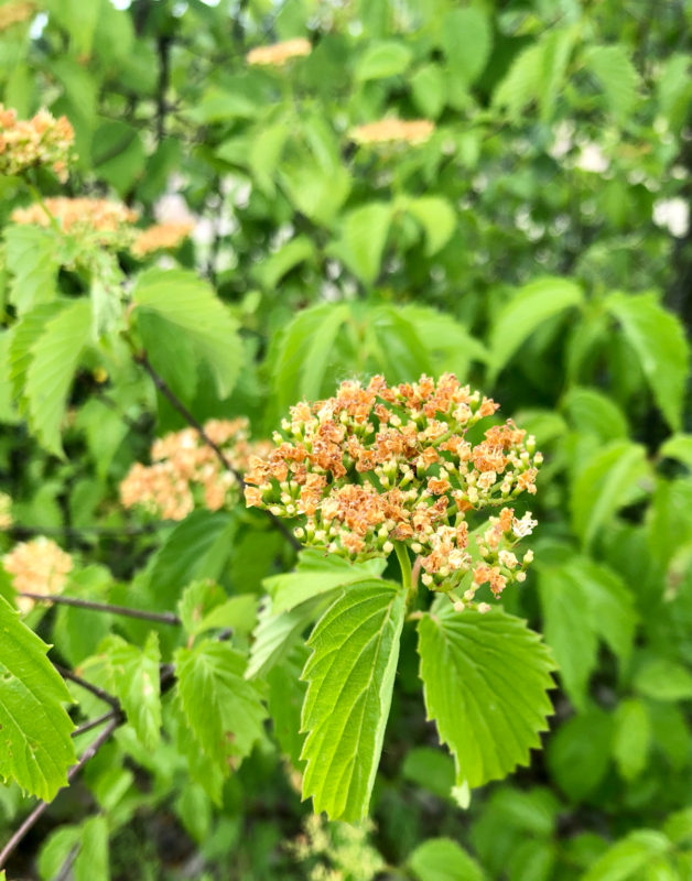
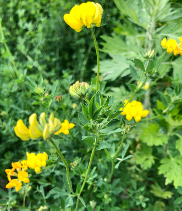
There’s viburnum, serviceberry, bayberry, trefoil, mugwort, vetches, and maples along the path, plus a brook, and (currently dry) pond, which means birds. The pond, when it’s not desiccated, has noisy frogs. Sometimes there are hawks circling overhead.
As you should expect, there are buses on the busway, but that’s it. You’re not having vehicles idling alongside you. They’re not honking. The buses are frequent, but not constant, so if you want to sort of be alone but feel like someone will notice if you fall and can’t get up, this is a happy medium. There are also other trail users. It’s not filled with lots of people noise; it’s not deserted.
When you’ve had your fill, go to one of the stations and take the bus back.
Today, when returning from a short walk, the crowded bendy bus I was on slowed way down and came to a stop when there wasn’t a station. Everyone was moving around, out of their seats, trying to see what was going on. Two deer crossed the path, then bounded over the railroad tracks and into the woods. Unfortunately, I was not on the right side of the bus to get pics of that.
I enjoy what’s useful and unobtrusive. Always have. There’s nothing about the CTfastrak path that screams “placemaking” at you.

The other end of the path is at the major bus station in downtown New Britain.
If you want to try something different without it being an ordeal, the CTfastrak multi-use path checks that box.
THIS COULD BE HOUSING
But back in Hartford, as I walk to the places I go, I really can’t stop seeing all this wasted potential.
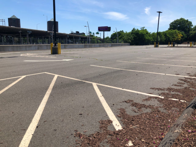
This surface lot, owned by Aetna, wedged between the CTfastrak Sigourney Street Station and Piggy’s, is 0.9 acres.
Why would you ever keep a large surface parking lot next to a bus rapid transit station? This could be housing.
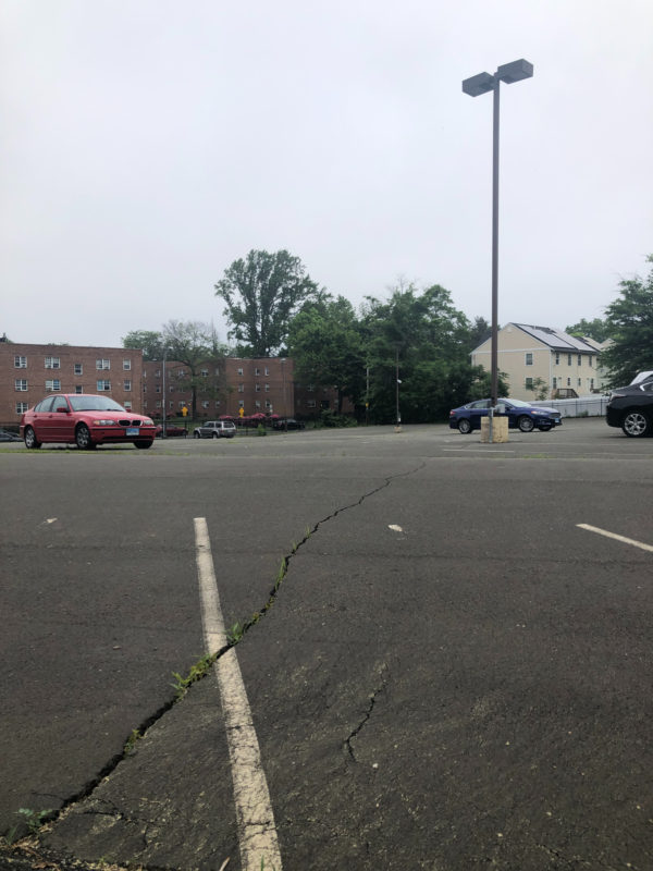
This lot, diagonal from the one above, is also owned by Aetna. This is 2.2 acres on Hawthorne Street that could be better used for housing.
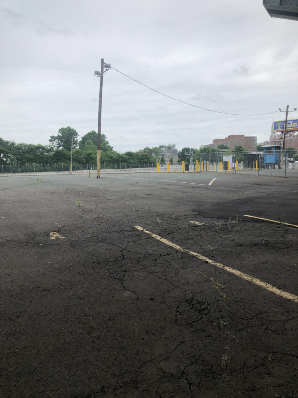
And then there’s this expanse around the corner, between Capitol Avenue and the railroad tracks. These three parcels, owned by Aetna, amount to 6.58 acres. Some of that is covered by the I-84 Aetna viaduct, and some is right up against the train tracks. . . so, plot twist. . . maybe instead of housing, this can be the grand total of surface parking that Aetna is allowed to own in the city, and those other sites should be converted to something much more useful to the fabric of the community.
The City has kissed up to the insurance companies for so long, when it really ought to be the other way around.
I CARRIED A WATERMELON
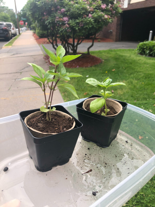
Okay, not a watermelon. But I was surprised with two basil plants in a tub of water, so these came with me on my 1.5 mile walk home. I did not spill a drop of water — an accomplishment considering how routinely I dump coffee on myself — and it sparked at least one friendly argument between two guys who were debating whether or not I was schlepping marijuana or basil.
SEEN WHILE WALKING TO PLACES

It’s not hard to stop and smell the roses when you’re going about two miles an hour.
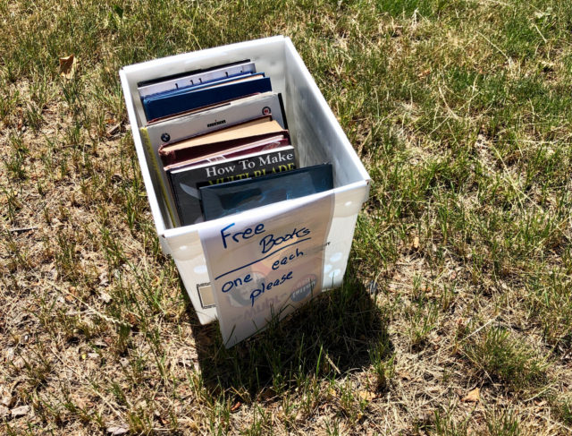
The Little Free Library on Asylum Avenue has overflowed into this box.
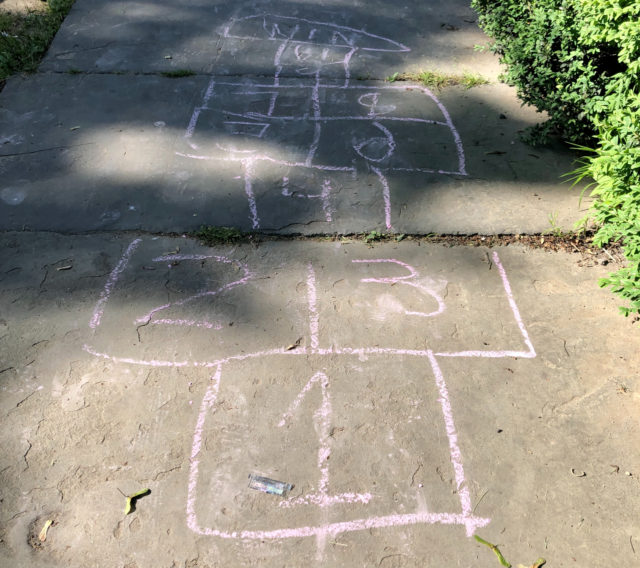
I wonder if kids today understand how to play hopscotch. I never did. They’re still drawing it on the sidewalks though.
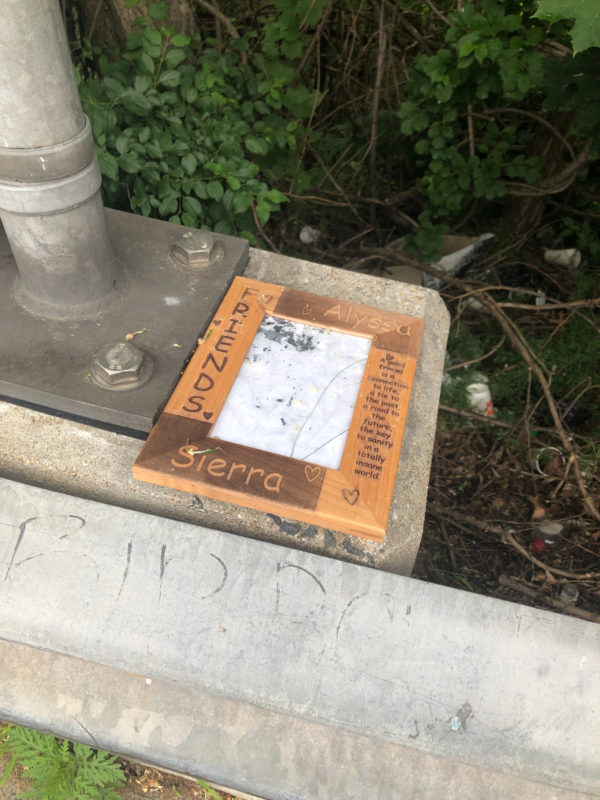
This looks like drama. C’mon you two, work it out.
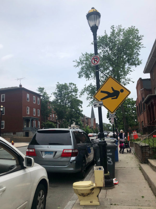
Broad Street, where you can find a 30 MPH posted limit on a road with narrow sidewalks that become even more narrow by garbage cans and other clutter. The broken pedestrian sign feels like truth in advertising.
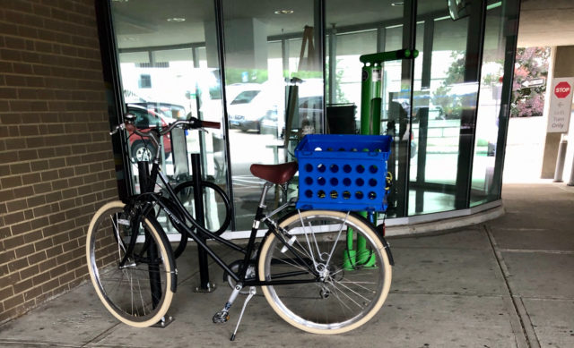
It’s nice to see people using the new(ish) and improved bike racks around the library. That old one was falling apart and sort of hidden away.
Here is how Hartford missed a wicked opportunity:
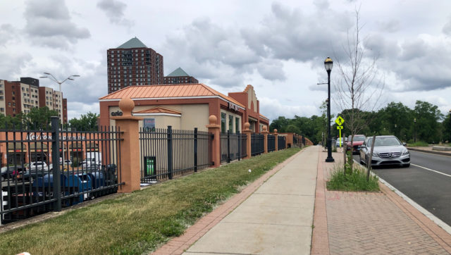
We could have had bike lanes on Park Street, but instead someone insisted on there being on-street parking even though there’s a whole surface parking lot right there. It’s not too late to make this right.
WHAT NEXT?
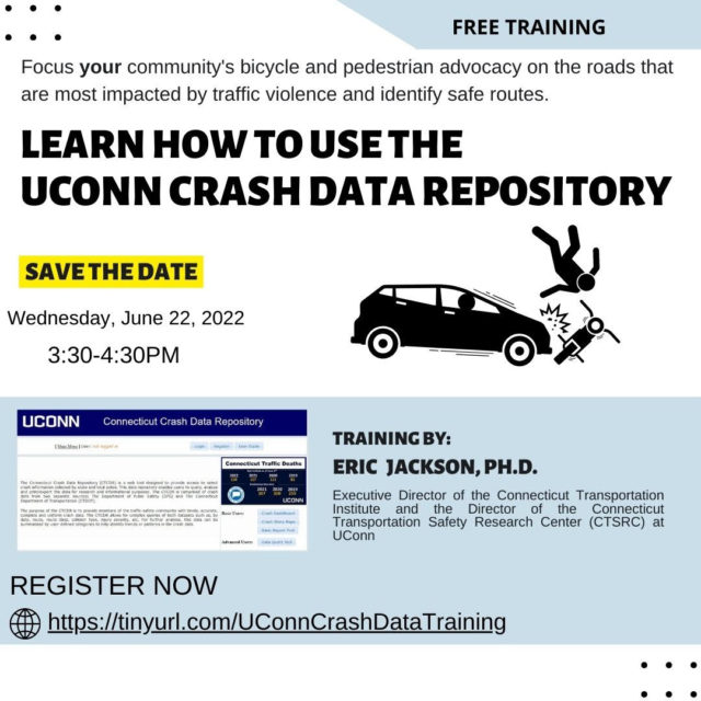
1. If you’ve wanted to be a more effective advocate for safer streets, or just wanted to understand the issues better, sign up for a free training on how to use the UConn Crash Data Repository. This is the place that can tell you how many pedestrians were wearing hi-vis clothing when hit or where someone was located in the roadway when struck by a driver. The training will take place online on June 22, 2022 from 3:30-4:30 PM.
2. Now is a good time, West Hartford residents, to ask your elected people to spend more time making significant changes to how pedestrians and cyclists, especially, are treated. When they make streets safer for people on foot and bicycle, they’re also making it safer for automobilists and their passengers.
Car-Free Diaries: Week 27
Instead of screaming into the void of Twitter, I bring you a weekly highlight reel of what it’s like going places in Greater Hartford when one is gloriously car-free. These posts are on a slight time delay because nobody needs to know exactly where I am when I am there.
Believe it or not, I had things I wanted to do in the last week that did not involve going hard on the neighboring town’s government. . . but I’m sure that the pedestrian who was murdered last Friday had things he wanted to do as well.
I become less patient with people’s shoddy excuses for inaction the older I get, and when I hear from West Hartford apologists, I just can’t.
When I’ve asked why Trout Brook Drive is so terrible, I hear about how there was a road diet on North Main Street. Where?! Really, where? If it’s not obviously improved, I’m not feeling it was much of a diet.
And then there’s the bike path.
My first question will always be how do you get to it? Once on it, great. It’s beautiful. But most of its sections spits you out in a place that is not ideal for kids learning to ride, or for anyone.
The newest section goes along Trout Brook between Farmington and Fern.
How do you get across Farmington? Nothing has been done to improve the road. Was the thought that people would just live on this stretch of bike path?
Here’s a scenario for you: I want to visit with a friend who lives on one of the side streets between Trout Brook Drive, University of St. Joseph, Albany Avenue, and Asylum Avenue. How do I do this? Bus service is spotty in this part of town, and more so the later in the evening it gets. There is no sidewalk along portions of Trout Brook Drive. There is poor street lighting. Biking on Trout Brook Drive is not safe. Tell me how a pleasure path on the other side of the speedway that ends one mile away helps with that?
It’s hard for me to care about things that feel like shiny distractions from surrounding unresolved issues.
The photos below above and immediately below were taken when I got off the bus to meet up with a friend in the Center, days after the pedestrian murder, when this was truly the last place I wanted to be. I was greeted with yet another half effort — a bike path with unsafe street crossings in a “walkable” town center where cars are prioritized, in a town with painted bike lanes in which people park because they think their convenience is more important than someone else’s safety. The Town of West Hartford couldn’t have sprung for a few well-placed bollards for any of those painted bike lane? Couldn’t have dramatically reconfigured any of those lousy intersections people are asked to bike across if they want to use this scenic path?
A few days later, I learn about how a motorist drove his/her pickup truck off of South Main Street into a telephone pole, breaking it. A photograph of the truck shows it on top of the sidewalk between Boulevard and Park Road. If you design streets like race tracks, that’s when you wind up with a busted utility pole down the road from where four days earlier another driver took down a ped head and killed a pedestrian.
Why is this “pick on West Hartford week”? Because I’m not finding much to celebrate about a place that brags about how safe and walkable it is, while being not particularly either. They’ve had years to do studies and years to prioritize the safety of those in this town.
Anyway, there were places I lived before Hartord. One was New Britain. One was not West Hartford.
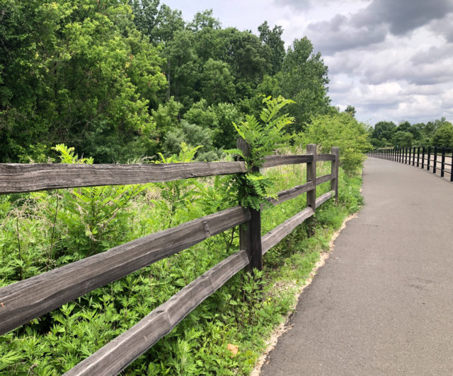
Over in New Britain and Newington, there’s a multi-use (biking/walking) path that runs for five miles along the CTfastrak route. There’s at least ten feet between users and buses, with a substantial fence serving as a barricade. Plus, bus drivers are professionals, so it’s already safer.
Here, cyclists can go for miles without interacting with motor vehicles. There’s a crossing on Smalley Street, East Main Street, and Stanley Street in New Britain, and cyclists can press a button to get green light to cross those two-lane roads. One section — East Street — puts you off the Fastrak for a bit and onto a less glamorous side path.
You tell me which path you’d rather let your kids and grandkids ride on.
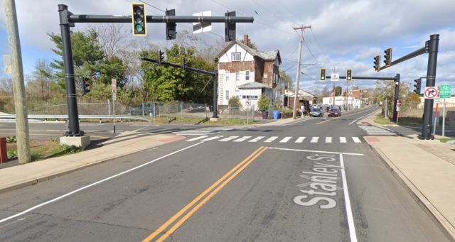
The one in New Britain that has this crossing:
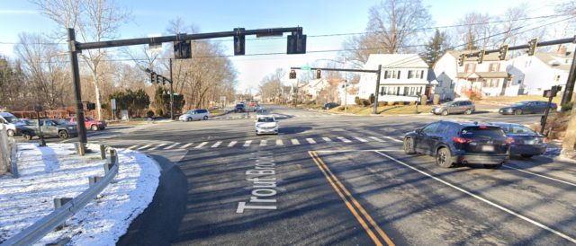
Or the one in West Hartford that has this road crossing:
It’s obvious.
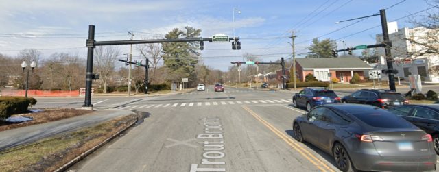
I know. I’m not being fair to West Hartford, so here’s another place where the WeHa path requires cyclists/walkers to cross the road:
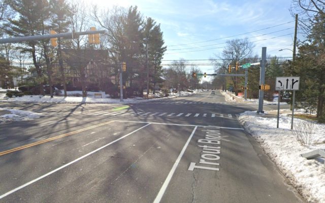
Sorry, I’ll let West Hartford have one more shot at getting it right. Here’s where its path currently ends:
You can tell me what you’re doing, or you can show me.
Anyway, ideally, the CTfastrak multi-use path wouldn’t end on Chapman Street in Newington, by the Newington Junction station. It would go to Hartford, at least to the end of the busway across from Union Station. It doesn’t do that, but you can safely board the bus with your bicycle.
And then what?
My current favorite activity is to bus/bike/walk to the Fenn Road Starbucks (Cedar St Station) and jet right in and out past the fools idling in the drive-thru line, (“pain at the pump” my ass!) then, wander on the path. It’s not the most scenic place in Connecticut, but for a quick mid-day break during the work week, it works.
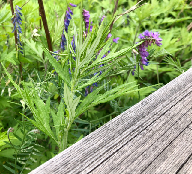
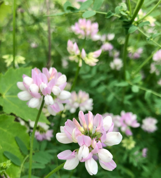
There’s viburnum, serviceberry, bayberry, trefoil, mugwort, vetches, and maples along the path, plus a brook, and (currently dry) pond, which means birds. The pond, when it’s not desiccated, has noisy frogs. Sometimes there are hawks circling overhead.
As you should expect, there are buses on the busway, but that’s it. You’re not having vehicles idling alongside you. They’re not honking. The buses are frequent, but not constant, so if you want to sort of be alone but feel like someone will notice if you fall and can’t get up, this is a happy medium. There are also other trail users. It’s not filled with lots of people noise; it’s not deserted.
When you’ve had your fill, go to one of the stations and take the bus back.
Today, when returning from a short walk, the crowded bendy bus I was on slowed way down and came to a stop when there wasn’t a station. Everyone was moving around, out of their seats, trying to see what was going on. Two deer crossed the path, then bounded over the railroad tracks and into the woods. Unfortunately, I was not on the right side of the bus to get pics of that.
I enjoy what’s useful and unobtrusive. Always have. There’s nothing about the CTfastrak path that screams “placemaking” at you.
The other end of the path is at the major bus station in downtown New Britain.
If you want to try something different without it being an ordeal, the CTfastrak multi-use path checks that box.
THIS COULD BE HOUSING
But back in Hartford, as I walk to the places I go, I really can’t stop seeing all this wasted potential.
This surface lot, owned by Aetna, wedged between the CTfastrak Sigourney Street Station and Piggy’s, is 0.9 acres.
Why would you ever keep a large surface parking lot next to a bus rapid transit station? This could be housing.
This lot, diagonal from the one above, is also owned by Aetna. This is 2.2 acres on Hawthorne Street that could be better used for housing.
And then there’s this expanse around the corner, between Capitol Avenue and the railroad tracks. These three parcels, owned by Aetna, amount to 6.58 acres. Some of that is covered by the I-84 Aetna viaduct, and some is right up against the train tracks. . . so, plot twist. . . maybe instead of housing, this can be the grand total of surface parking that Aetna is allowed to own in the city, and those other sites should be converted to something much more useful to the fabric of the community.
The City has kissed up to the insurance companies for so long, when it really ought to be the other way around.
I CARRIED A WATERMELON
Okay, not a watermelon. But I was surprised with two basil plants in a tub of water, so these came with me on my 1.5 mile walk home. I did not spill a drop of water — an accomplishment considering how routinely I dump coffee on myself — and it sparked at least one friendly argument between two guys who were debating whether or not I was schlepping marijuana or basil.
SEEN WHILE WALKING TO PLACES
It’s not hard to stop and smell the roses when you’re going about two miles an hour.
The Little Free Library on Asylum Avenue has overflowed into this box.
I wonder if kids today understand how to play hopscotch. I never did. They’re still drawing it on the sidewalks though.
This looks like drama. C’mon you two, work it out.
Broad Street, where you can find a 30 MPH posted limit on a road with narrow sidewalks that become even more narrow by garbage cans and other clutter. The broken pedestrian sign feels like truth in advertising.
It’s nice to see people using the new(ish) and improved bike racks around the library. That old one was falling apart and sort of hidden away.
Here is how Hartford missed a wicked opportunity:
We could have had bike lanes on Park Street, but instead someone insisted on there being on-street parking even though there’s a whole surface parking lot right there. It’s not too late to make this right.
WHAT NEXT?
1. If you’ve wanted to be a more effective advocate for safer streets, or just wanted to understand the issues better, sign up for a free training on how to use the UConn Crash Data Repository. This is the place that can tell you how many pedestrians were wearing hi-vis clothing when hit or where someone was located in the roadway when struck by a driver. The training will take place online on June 22, 2022 from 3:30-4:30 PM.
2. Now is a good time, West Hartford residents, to ask your elected people to spend more time making significant changes to how pedestrians and cyclists, especially, are treated. When they make streets safer for people on foot and bicycle, they’re also making it safer for automobilists and their passengers.
Related Posts
HPD Releases Preliminary Investigative Report for Blue Hills Shooting
Look: Snow and Shadow
The ATV Menace