In Connecticut, we are expert-level at metaphorically hiding our treasure. Sure, we’ll put up highway signs and a bit of fuss over Mystic, Hammonasset, and the casinos, but then act as if nothing else exists.
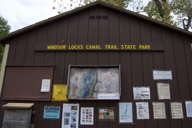
There is not much in the way to point you to the park. Not on the road. Not online. Unless you happen to follow the writing of the few locals who seek out lesser known attractions, or live in the immediate area surrounding the park, it’s possible to be in Connecticut and have no idea this 4.4 mile linear trail exists.
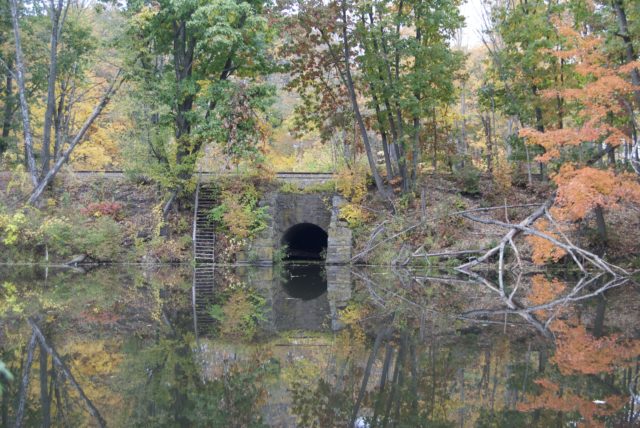
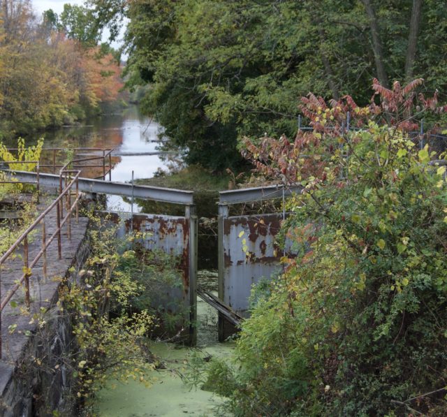
There is minimal information on site about the history of the canal, which was built using the labor of 400 immigrants in the late 1820s to provide a detour around the Connecticut River’s rapids. Boats going north from Hartford could make it to Warehouse Point, but would struggle when they encountered the Enfield Falls.

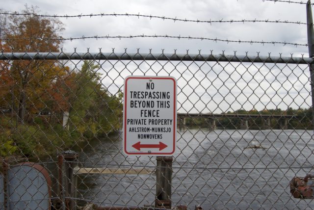
The canal operated for about fifteen years, moving boats through a series of locks. Its decline was blamed on the Hartford and Springfield Rail Road Company, which began running in 1844. As one author¹ put it, “steamboat communication between the two cities became unprofitable.” The valve house, visible from CT-159, is among the infrastructure still visible today.
To fill the economic gap, the canal was put to use as a producer of power. At various times, it powered a gin distillery and multiple mills: grist, silk, saw, wire, cutlery, and paper. By the early 1880s, thirteen mills relied on the canal for power. When the canal was flooded or too dry, mill workers would get time off, and this was notable enough to get mention in the daily paper.
From there, it would segue into other uses. A local organization planned a “bike hike” in 1969, and it appears that a park was first proposed in 1973. The towpath bikeway was established two years later. Mere months after the bike path opened, the DOT decided to close it from Halloween through the “winter season” to give priority to hunters using the land, which had been owned by a utility company. Again, waterfowl hunting season booted cyclists and other trail users for months. In 1977, a newspaper report noted that people fishing and cycling would be able to co-exist in the space during shad season. The Courant wrote: “the conflict arose because the two state agencies were operating recreational activities which [DEEP] believed weren’t compatible.” They had been closing the path from the third Saturday in April through June 15 to cyclists. The fickleness about who could use the space and for how long seems bizarre, but then, more recently, it was closed because of some vague insurance issue connected to the Montgomery Mills redevelopment.
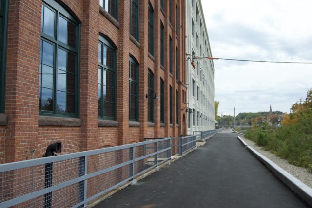
The idea for a park re-emerged in 1988, when the DEEP [née DEP] hauled out its “heritage state parks” plan. This was also the year that the Montgomery Co. announced it would be leaving Windsor Locks. There was no Dear John Connecticut genre yet at the Courant, so the details on this move were minimal, but housing costs were cited as a problem for the company.
Within the next year, a plan to convert the mill to apartments was dropped by the developer, who must have felt it was a losing battle against Windsor Locks. Town officials brought up “concerns” about “flooding of the parking area, a lack of supplementary parking space, traffic and access for emergency vehicles.” I’ll just be over here screaming over how a solid adaptive reuse proposal got shelved for decades because of Windsor Locks’ inability to imagine housing without excessive parking.
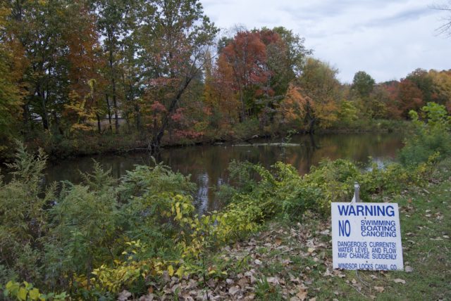
Industry is only one dimension of the canal’s history. A somewhat salacious newspaper article from 1955 claimed that one life was lost every year at the Windsor Locks Canal. Many were said to be suicides. I can’t say if that estimate was accurate. From 1908 through 1989, I saw reports of twenty bodies found in or near the canal, including that of a 20-year old woman who was murdered. A few were categorized as accidental drownings, like a 45-year old man who fell out of his boat. Much ink was devoted to the plight of Walter Drake in 1934, who was encased in a block of ice. Authorities took days to figure out how to retrieve him. A 50-year old male who lived for seven years in a cave by the canal was found by a couple of youth. He was described as a hoarder who died of natural causes. In 1970, a 22-year old male was found on the canal bank, a motorcycle crash victim.
There were multiple cases of vehicles crashing in or near the canal, actually, though the drivers in other wrecks managed to escape with their lives. One of the more dramatic incidents involved a train striking a truck, forcing it into the canal; there were injuries, but no deaths. A stolen car was found abandoned in the canal in 1964.
If there is a body of water that people do not have to work hard to access, they will find a way to drown or ditch their cars in it.
Then, there were the flashers. A Massachusetts man was arrested in the 1990s for exposing himself on the trail, but he was not thought to be the repeat offender that police were hoping to catch.
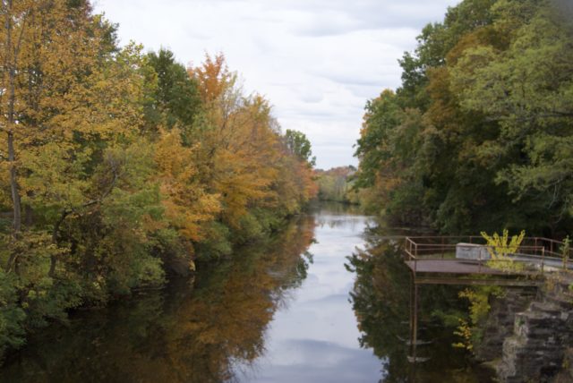
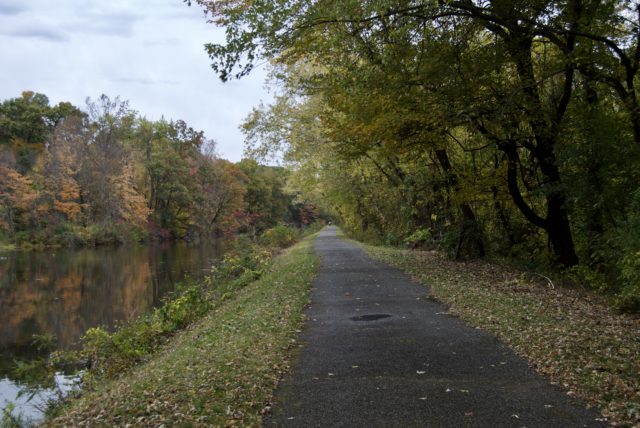
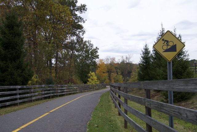
The southern end of the path begins near the Montgomery Mill Apartments, which just completed its conversion from industry to housing in 2019. The flat, paved path between the canal and Connecticut River ends in Suffield. Though the canal continues south of 140 for about one mile, the park and trail are situated between 140 and 190. There are picnic tables and portapotties at both ends of the trail, and ignore the remarks you might find online about needing to walk by a dilapidated building to enter the park — that’s outdated information, now that the mill renovation is finished.
This could be a tedious walk, I suppose. If there were interpretive signs, I missed them. At the height of summer when vegetation mostly blocks views of the river, the novelty could wear off quickly.
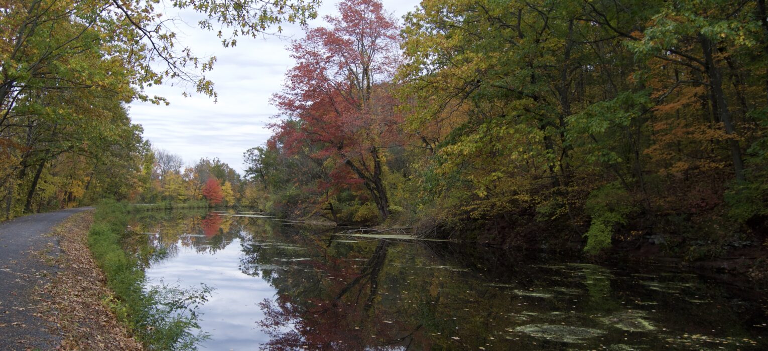
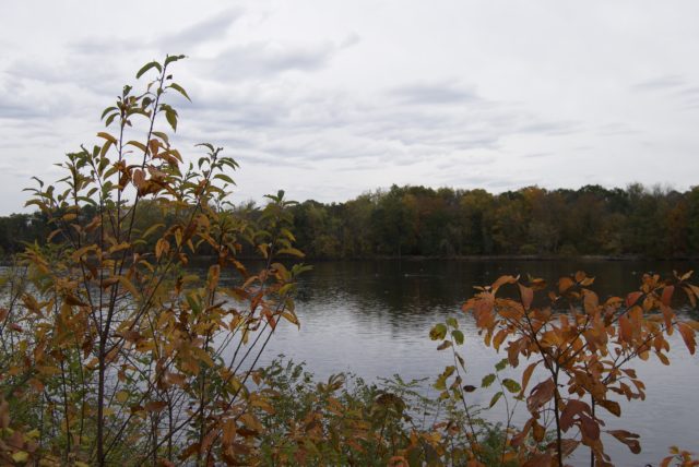
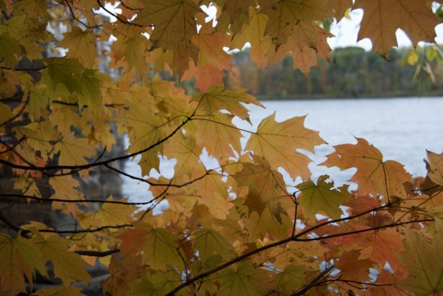
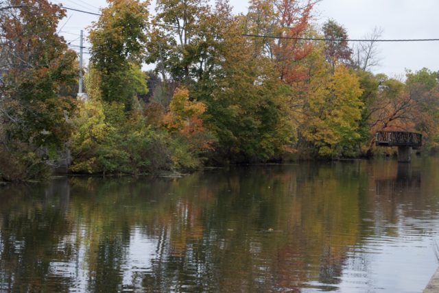
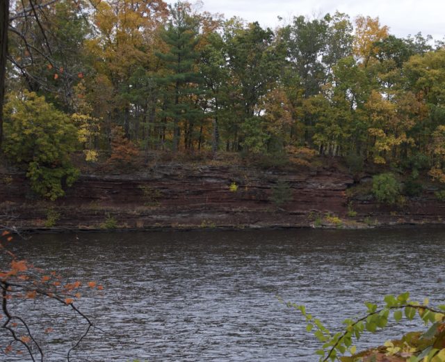
In autumn, though, colorful foliage adds interest, as does the many opportunities to take in the Connecticut River, especially while passing the 120-acre Kings Island.
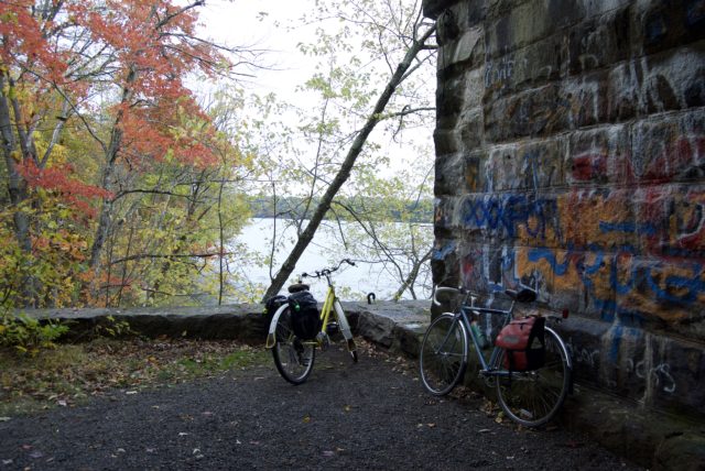
Experiencing this on bicycle might be preferable to walking, because it seems more like the right amount of time to spend here — and I say that as a dawdler, not as someone who gives a shit about setting land speed records. Maybe I enjoyed this more than it deserves because I rode my bicycle on Route 5 in East Windsor² to get there. The path is somewhat bumpy, though not any worse than riding on Hartford’s pothole-filled streets. At times the trail feels narrow, but that is more illusion due to being surrounded by water without much land buffer. It can feel like if you sneeze too hard, you’ll ride right off into the drink.
Today, CT DEEP likes to close all or part of the park for months at a time to protect wintering bald eagles. I can’t be mad at that, but I wonder if similar measures are taken to close portions of highway when bald eagles are discovered to be nesting nearby. I think that’s something DEEP ought to consider if they are serious about protecting wildlife. But anyway, I’m happy the Windsor Locks eagles are doing well and are not being hit by cars.
The park is, at least for the time being, open from April 1 through November 15.

For historical photos of the canal, check out Windsor Locks Canal by Maria Giannuzzi and A Brief Account of the Windsor Locks Canal: Bicentennial Project, 1776-1976 by Edward E. Lanati¹.
²Dear East Windsor, Get your shit together! It’s bad enough that your greenfield sprawl has wrecked the farmland. How do you not have protected bike lanes or even sidewalks along Route 5?
Tom
I love this trail! It also has … Windsor Locks. Actual locks! Padlocks. At the Enfield end, people have taken to putting padlocks on the fencing, like in Paris. Get it? Windsor … Locks. I love a good visual pun. This also makes the artificial waterway a … Love Canal. (Google it.)
Chris
Good read – I biked here last year and am glad to hear that the dilapidated mill is no longer relevant. I had no idea that was being converted into apartments so I imagine it must be much nicer now.