A flat gray sky and seasonably chilly weather has scared almost everyone back indoors, already. From the wooded area that begins just north of the boat house, until the path peters out by the railroad tracks behind Midland Street, only four other people pass — three cycling, one jogging — in what amounts to 2.5 miles. 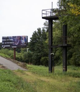
This has become a point of obsession: why do so many Hartford residents routinely schlep up to the crowded West Hartford Reservoir when the maintained trails through a wooded area along the Connecticut River offer water views? Other than matters of personal taste, is it that people do not know about this spot?
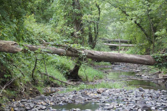
Riding between the Connecticut River and a flood control dike, you can hear birds and see the occasional deer. Hawks circle. By the island, there are beavers. Going north of here could mean a visit to the goats in Keney Park or lunch at The Original Ranch House in Windsor. You could potentially get onto a paved path to Windsor Meadows State Park and then take the bike path across the Bissell Bridge.
What’s the obstacle?
The most direct route involves crossing active train tracks. Putting aside legal issues, this option has become riskier with the addition of more trains running between Hartford and Springfield. And, this segment of track does not have a flat, wide shoulder, but is a mess of loose trap rock. Sharing this space with a train seems unwise.
The other possibility would be crossing Meadow Brook and taking a dirt road onto Meadow Road. If the water is low, this first step is not terribly challenging. Once you cross, a sign could point you in the right direction or tell you if stepping on this land would be considered trespassing. There is no wayfinding one way or the other.
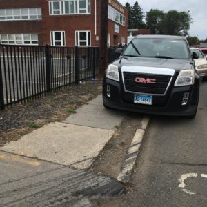
Biking along Windsor and Main Streets shows why a separated bike path is preferable as a way to go from Hartford into Windsor, whether you are trying to get to a meeting or taking a leisurely trip. The bicycle lanes on Windsor Street are often filled with illegally parked cars. If your solution to this is to ride on the sidewalk, that won’t work; the sidewalk is sporadic, and cars are also parked on that. These are all solvable 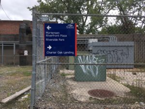 problems.
What happens if you try to travel south of the boat house?
This path is well-maintained and paved, and as such, gets more use. Until recently, wayfinding was lacking once you got beyond Mortensen Riverfront Plaza. Not everyone is curious enough to wander off and learn for themselves what is in unmarked areas.
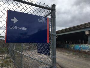
Signs were recently added, pointing users to Charter Oak Landing, Riverfront Plaza, Riverside Park, and Coltsville. For those trying to enter the path from Coltsville, the signage shows that there really is something tucked behind an industrial site. 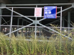
This is an important step toward telling people how to get elsewhere, but what about beyond Charter Oak Landing? There is a walking/bike path on the Charter Oak Bridge, but are there any signs for that? Why have we not figured out how to connect to Old Wethersfield? Those who have served as bike messengers might not mind the ride down Wethersfield Avenue, but the average cyclist is more risk averse and would welcome a calmer route.
What’s the obstacle?
 The flood control dike, which requires maintenance anyway, could bridge this gap. There is the matter of getting around the trash-burning plant. Again, all solvable problems, most of which do not come bearing hefty price tags.
Another viable option would be to install serious bicycle infrastructure — physically separated and protected bike lanes — along major corridors and to routinely enforce traffic laws.
Hartford is part of the Knowledge Corridor — surely someone can figure this out.
Tony C
North of Hartford – It’s a real bummer that the new rail bridge for the Hartford Line wasn’t built with enough width for safe crossing of the Meadow Brook. Until they get funding for the bridge and right of way through the Russo Property, they’ve built in a safety hazard. Funny to build in hazards, right? I like the idea of signs that point folks across the Brook scramble instead.
Kerri Provost
Thanks for the extra information!
Tony C
South of Hartford – The plan to connect to Wethersfield is in the new citywide bike plan. Wethersfield is very interested in that. The challenge there is Brainard Airport and getting access along the MDC road. There also a really nasty off angle rail crossing on Reserve Road that needs to be addressed.
Tim
Approved during this week’s State Bonding Commission meeting: $1 million grant for Riverfront Recapture to extend the Hartford Riverwalk north of Riverside Park. Don’t know more than that.
Kerri Provost
Thanks for the good news, Tim!