Now that we have completed our three trips to each neighborhood, we wanted to share our absolute favorite pictures from this series.

(Blue Hills) This one was taken at the Watkinson Community Garden on Bloomfield Avenue, behind the Unitarian meetinghouse. This is more like a farm than a community garden. We have no idea why this wheelbarrow was perched in a tree; on other trips here, all equipment was stored in places one would expect it to be. The weather was changing from “vaguely Autumn” to “there’s frost”.

(Clay Arsenal) A friend tipped us off to some artwork in an area we were about to visit, but did not give an exact location. We do not even know if this was where he found the painting of a peacock. What we found — portraits — were more interesting than the simple scribbles that are common.

(Downtown) That’s not to say that words aren’t powerful. They can be. We enjoy seeing something grow Downtown (Heaven) that is organic, not engineered into blandness.

(South Green) Part of this experiment involved only walking or cycling to get the photos. We interact with space differently when we are immersed in it, versus when we are in a cage going 40. A lot of what would be missed are those things behind fences, especially on construction sites.

(Clay Arsenal) This car is just great, but it also had a note in the window telling passersby that if they had anything to say about its condition, they should donate money toward its refurbishing. That note would definitely be unreadable to those speeding by.

(South West) We like to imagine the streets being filled with antique cars. So much more character than most of what’s on the road now.

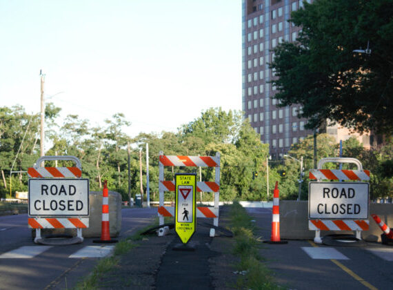
(Behind the Rocks) Some photos really need to be worked for. This one meant handing off the camera to a taller person and a lot of jumping. This is on a street that has been dead-ended. On a different day, we saw a young child with no helmet riding an ATV unsupervised. A police car drove by the street, so we assumed the officer would head down there to check it out. He didn’t.

(South End) It would have been easy to get flattering pictures of the South End had the only subject been food. Readers would have been craving tiramisu and there would have been no complaints. But this series was supposed to move us away from what was comfortable, so that meant walking down some streets we would normally dodge and going to parks that we are underwhelmed by at the moment. The South End was admittedly a challenge for us. The main avenues are not particularly pedestrian-friendly; one can walk for a long time without finding any real public place to rest. There are not many benches, no parks until almost Wethersfield, and no library branches. Well, the Camp Field branch exists, but that is more Barry Square and definitely not central to the South End neighborhood.

(Sheldon-Charter Oak) The park above has been getting fixed up over the past year. The changes here are commonsense ones — new playground equipment and sprucing up. There are usually people here, but this was an early start to the day.

(Blue Hills) During the fight to keep Flower Street open for pedestrians and cyclists, we have been subjected to such wild rhetoric that would convince someone that train vs. human accidents are the leading cause of death in the city. While nobody actually made that claim, we’re surprised. We see people in various stages of sobriety walking on or near tracks often, but actual collisions are infrequent. The tracks up in the Blue Hills neighborhood show signs of someone having walked right down the middle of them. We merely paused for a moment while crossing.

(North East) It started pouring a few minutes after this picture was taken at the former Swift Factory on Love Lane. Days after it was taken, a nearby street developed a sinkhole following a water main break. A few days later and a few blocks in another direction, there was apparently a shootout between an armed man and police officers.
This picture strikes a nerve. Movement on rehabbing this factory has been glacial. The photographs lining this fence act as a reminder — intentional or not — that there are people living around the factory who are impacted by neglect. Boarded up windows and chain link fence — are those things most people would choose to reside near?
It is outrageous to see how much attention and money get poured into certain projects that benefit Downtown, while many of the city’s neighborhoods struggle so visibly.

(Frog Hollow) The photo above is not a good photo. It’s too dark. It’s cropped weird. But we like it because it shows hope on a block where it had otherwise been one mess after another this past year. The picture shows 387-389 Capitol Avenue, a building that had been neglected for years. It switched owners and is now being rehabbed; the owners plan to actually live in the building. A Hartford Prints! “Love Hartford” poster can be seen in a window, and it does not appear to be displayed there ironically.
(Upper Albany) For similar reasons, we like the picture below. This was taken right at the Upper Albany/Blue Hills boundary. The billboard in the background is usually advertising some kind of liquor. There are buildings nearby that need love and renovations. And the flowers themselves are from the City of Hartford’s LSNI, something that got off to a rough start for a variety of reasons, but is now making progress.

(North East) The house below actually is a “before” picture, but we did not know this at the time. After, we learned this was one of several houses that Rebuilding Together and LSNI would be helping to rehab. Honestly, we thought it was plenty cute here and assumed the owner was just being whimsical by not bothering to have shutters. This is on a quiet street near Keney Park, one we considered buying a house on. We got the sense that the homeowners on this street are competitive about lawncare and house maintenance, so while the home below was definitely not terrible by most standards, it did stand out on this particular street.

(Sheldon-Charter Oak) This neighborhood has been getting a lot of new housing lately, but we much prefer the older architecture (below) to the newer styles. The houses below are unique.


(Blue Hills) The housing stock in the Blue Hills neighborhood also has some interesting designs, including the one pictured below.


(Blue Hills) We took this photo in the early morning and walked into the field to get the shot. This meant freezing feet and sneakers coated in wet grass clippings. The fog romanticized what is not this building’s best angle.


(Behind the Rocks) We’re not huge fans of the term “urban pioneer.” It’s fraught with racial implications, and flat out, inaccurate. Sometimes we come across things that nobody had told us about, so it might feel like discovery, but we know we can not actually call it that. There is nearly always some proof right away that the spot has already been “discovered.”
The two pictures above are of a bridge in the Behind the Rocks neighborhood which we have seen before, but on this snowy day, we could see it was covered in footprints and bicycle tracks — a sign that even on a day when few people are out and about, these “secret” spots are getting attention.
(Frog Hollow) The same can be said of this bench in Pope Park West. We had been to the park before, but only recently noticed trails leading to a few nice benches. The little bits of litter in the area served as reminders that we have no business calling ourselves — or allowing others to call us — urban pioneers.

(South Meadows) The photo below is more a sign of frustration than anything. Most of our In Your Neighborhood trips happened on the weekend — when we had the most time to just walk or bike around — and as such, it meant some things were closed. There is a bike path in the area near this dike, but it was not open on the weekend.

(West End) We had been told there was a path along the Park River in the West End. There are no signs pointing to where this is, so after talking to a few residents who might know, we ventured down a slippery slope and there it was! There are a few segments of path along the Park River that we prefer, but this is worth finding at least once.


(Upper Albany) This building is another reminder of how much stalling is allowed when it comes to the neighborhoods. Unlike the Swift Factory, tucked in a residential area, the Northwest School is on Albany Avenue. In 2010, the Courant wrote an article about how funds were being raised to convert this into the John E. Rogers African American Cultural Center. The photo taken in 2013 shows a ripped banner announcing as much. Externally, it does not appear that any progress has been made in the several years since that article ran, despite having received a $1 million state grant two years ago. It had been hoped the cultural center would open in 2014. We would like to see that.
It was also in 2010 when part of the old Lyric Theater at Park and Broad was demolished and talk began of turning that into a space for the Park Branch of the library, or into a center for Hispanic culture; the latter is a project Mayor Segarra has pushed. Aside from securing the remainder of the Lyric Theater, not much progress seems to have been made there.

(South Meadows) We came across this while walking around the Regional Market, which presents a challenge in its limited hours. There was a huge plant sale that morning, but we found the railroad tracks more interesting to look at.

(South West) Cedar Hill Cemetery is one of our favorite spots in Hartford to meander with a camera. We had to force ourselves to get out of the familiar spot, but did allow a few pictures, including this one. The statue does not normally hold flowers.

(Sheldon-Charter Oak) We walked by this plaque dozens of times before ever noticing it. This is on the side of an apartment building on the corner of Charter Oak Avenue and Charter Oak Place, and across from (what we think is called) Charter Oak Tree Memorial Park.

(Asylum Hill) This vacant diner gets photographed a lot, but not often from this angle. Our guess? People are taking pictures from their cars while stopped at the light.

(Behind the Rocks) There is a street in this neighborhood that has been barricaded to traffic. It, and the adjacent streets, gets used as an illegal dumping site. People do live in the area, but there are so many vacant buildings that there is no sense of eyes on the street. On various walks to this area, we have found: furniture, bags of clothing scattered, a dead dog, tires, paint, lots of broken glass, and a boat. Not a toy boat. Not a canoe. A large motor boat. How does nobody notice a boat being ditched?
A manhole cover has been missing for months.

(Behind the Rocks) The water running into the Park River is not healthy. There are signs nearby indicating as much. That’s untreated sewage/wastewater being dumped directly into the Park River.


(Barry Square) Not that it was a contest, but we thought that the Barry Square neighborhood really kicked it up in terms of directness when it came to signs telling people to pick up after their dogs. We saw variations on this citywide. The ones we saw in the West End seemed to err on the side of politeness. One street in Parkville looks like several neighbors went in on a discount for a certain type of sign. But these two residences just win.
(Barry Square) Below, a message in Barry Square aimed at contractors doing work on Crescent Street. We found this sad and hilarious, since we saw no signs instructing students, faculty, and staff to return that respect to those building the student housing.

(Blue Hills) Below, one of the last two public housing projects in Hartford. We actually like how these look on the outside and hope that they are replaced by something more respectable than the ugly model of townhouse-with-vinyl-siding that has come into favor in recent years. We vote for brick construction.

(Parkville) The two photos below are not aesthetically pleasing to us. These are included because they show the impact of this busway project in a way that just can not be spun by any public relations. The first shows the area behind UHaul and Real Art Ways. This area had been meadow with a narrow path along the tracks. It was a habitat for animals. Now…well, look at it. The second photo shows how this project affects people. The sidewalk on both sides of Park Street was closed, forcing people to walk in the street. This is a stretch where motorists regularly speed. Here, the family is walking in a bike lane, which could also impact cyclists. There are no signs warning sidewalk is closed ahead — just a sign when it actually closes. Seems like common sense has been sidetracked for CTfastrak. An agency that forces pedestrians to walk in a busy city street has no business ever claiming it promotes Complete Streets.
![]()


(Clay Arsenal) There are some who contend that Clay Hill remains its own unique, separate neighborhood. This sign seems to support that argument.

(Clay Hill) Above, it looks like the statue is contemplating the situation. It is not obvious from this photo, but the ground is littered with trash. Markers and monuments have been vandalized in the Old North Cemetery.

(South Green) Construction, a community garden, a mural, the hospital, and South Park Inn. The raised beds are on one corner of Park and Main, where there had been overly ambitious plans for “Plaza Mayor,” a project that would have involved the construction of two towers with luxury housing and retail. That plan was scaled down to townhouses and a small retail plaza. And then it vanished. This photo shows the nicer corner.

(Clay Arsenal) This past year has featured a whole lot of designers determining what is best for Hartford, without much talk to those who live in the affected areas. Above is a picture of the lumberyard. At one such meeting, the “dreamers” tossed out the idea of moving the lumberyard to an industrial area so this neighborhood could be made more cohesive or something. When we asked if this business was on board, we learned there was no outreach at all to one of the oldest businesses in town. Well done.
We are guessing those design folk had no idea that train tracks go through the lumberyard.

(North Meadows) Above, just a few early signs of Autumn. We like photos that make a mockery of those who claim cities lack nature. We have had conversations with those who refuse to move to any city because they will “miss trees too much,” which is silly because most of Hartford does have a decent amount of foliage. Again, if you only see the city from I-84 or only come to the central business district, then you might never know you could definitely get lost up in Keney Park or contract poison ivy by the Connecticut River.

(Asylum Hill) The berries above were found on the Broad Street bridge. What bridge? The one over the highway. This is something too hard to see unless standing right next to it.

(West End) The Brussels sprouts were in the West End Community Garden.

 (Barry Square) The two pictures above show the very photogenic Trinity College campus in Autumn on a day when the foliage was gorgeous. There was no photoshopping color or light in those pics.
(North Meadows) Some kind of project was underway in this area near Riverside Park. This was taken just a bit before sunset on a day when the mosquitoes were fierce.

(South West) The two photos below represent our first trip to Hyland Park, a place we had driven or cycled by multiple times, but never slowed down to go through.


(Frog Hollow) Zion Hill Cemetery offers some views of the city, but on this day, we were looking uphill.

(Frog Hollow) A few days after going to a PYO orchard in South Glastonbury, we found apple trees just outside of Downtown. We had passed these trees many, many times before.


(Frog Hollow) The path above and the park below never made it into the Hartford episode of Gangland, so maybe not so many people know about these spots.


(Blue Hills) The picture above was taken by the Park River, very early morning.

(Downtown) When people think “Downtown,” they think “Wadsworth” or “The Bushnell” or “work,” not “hey, giant piece of orange fungus on a tree.” Being alive means looking around, up, and down…not rushing through.

(West End) We wanted to show the rose garden in Elizabeth Park at a time that was not June when everyone goes. The park looks beautiful year round, but you can’t expect it to look like summer year round.

(Asylum Hill) Above, the Park River in autumn. This view is from a small bridge near Classical Magnet School.
(Behind the Rocks) Below, the Park River in winter, on a day when it was snowing. This was taken from a bridge near a street that was closed to traffic.

(Blue Hills) Below, the Park River. If you want to see wildlife in Hartford, check out this spot: deer, fox, rabbit, skunk, raccoon, and birds.

(West End) Skunk cabbage!


(Behind the Rocks) This picture above was taken a little ways away from roads and people, or so we thought. While nearly standing in the Park River, we could hear preschool kids nearby playing outside. This looks secluded, but does not sound so.

(Behind the Rocks) There is a path between Brookfield Street and the Park River. This is a view from that path.
(North Meadows) Below is the Connecticut River in winter. When ice is breaking up, there’s a spectacular noise to be heard as the chunks crash into the Bulkeley Bridge.


(Sheldon-Charter Oak) We were definitely not aiming to go around and photograph people for this series. Legally, we can do this in public spaces, but it seems to border on creepy. We have no such qualms about getting shots of cats that seem to pose for us.
(North East) We have no reservations about taking photographs of horses either.


(West End) We were aiming for the rose garden, got photo-bombed by a wedding. We have no idea who any of these people are, and we were not about to invade someone’s special day to be nosy. We like that her gown has sleeves.

(Frog Hollow) We had good timing, as these two men greeted each other on Park Street.
(North Meadows) And finally, a view of Downtown from the North Meadows.

Jim C
Impressive. That orange tree fungus you found downtown may be hen of the woods or chicken of the woods, very tasty. Connie Borodenko, a Westend mushroomer, would know for sure.
Kerri Provost
Thanks. I wasn’t planning to eat it.
Justin
Well done! I always enjoy this series but really, really liked this city-wide compilation. Even though your photos are documentary, or evoke the realism of documentary, there’s really an imaginative quality to all of them I think–something that I really dig about them. Particularly the close-ups and all the little minor areas like 10 foot paths near the small rivers. Having been in hartford for six months it can be hard, still, to adjust to the place. It’s beautiful but its socio-politics are kind of bleak… You can read Stevens’ poetry but its from a different time in the city’s history…these photos are up-to-date, of the moment… they help with what this scottish author alasdair gray writes about living in a city and it’s relationship to art of that city: “If a city hasn’t been used by an artist, not even the inhabitants live there imaginatively.” it’s a cheesy as shit sentiment, but thanks for helping us be able to better live here imaginatively! 🙂
Kerri Provost
I’ll take the cheesy-as-shit sentiment. Thank you!
Jim
While you were photographing were you able to pick up some of the litter and trash that you noticed? When you are riding with no particular destination maybe take a grocery bag with you to fill with the litter you happen to pass. It is a small gesture of kindness but could have a large impact on others who notice.
Kerri Provost
Sometimes I do, sometimes I don’t. If the litter involves syringes,broken glass, or human waste, I definitely do not touch it.
But it’s also the job of people to simply NOT litter.
Jim
In the case of syringes you just need to pick then up not by the needle. One would also assume that you have thick hazmat gloves ready when ever needed.
It would be nice if individuals would not litter but then prisoners would have less work to do during the summer.